

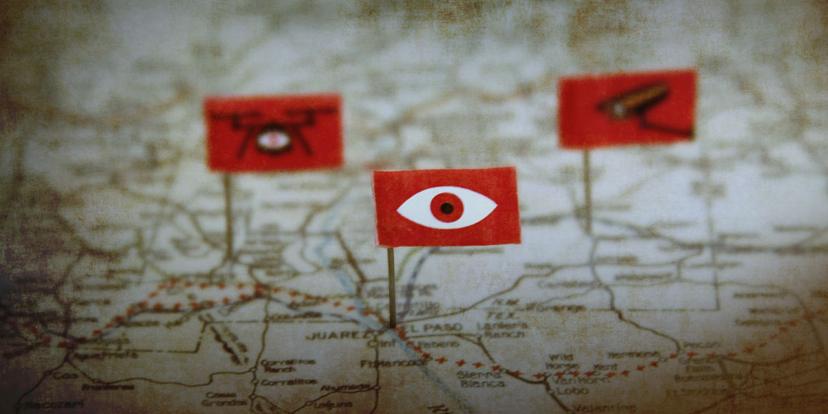
Surveillance Map

The Atlas of Surveillance: Southwestern Border Counties dataset was compiled by EFF and students at the Reynolds School of Journalism at the University of Nevada, Reno using online research methods. While we aimed to be as comprehensive, the dataset may include information that is outdated or incomplete. We endeavor to update this dataset periodically as new information is collected or submitted. Should you find items to add or correct, or if you do something super cool with the data, please email EFF Senior Investigative Researcher at dm@eff.org.
Update Jan. 24, 2020: We have updated the map to reflect the Jan. 10, 2010 changes to the dataset.
Update Jan. 10, 2020: We have updated the dataset and table to remove 30 datapoints related to face recognition in San Diego. These agencies in San Diego suspended their programs following the passage of a new law, A.B. 1215, which created a three-year moratorium on mobile biometric technology. The dataset also includes new information from Mission, Texas and other locations.
Download the dataset (Last updated Jan. 10, 2020)
The table below serves as a quick reference guide; for the sake of convenience, we omitted many fields that are in the original file linked above. The downloadable dataset also includes archived versions of the URL via the Internet Archive's Wayback machine.
| Agency | County | State | Jurisdiction | Technology | Town/City | LEA Type | Summary | Vendor | Link | Additional links | Source | |
|---|---|---|---|---|---|---|---|---|---|---|---|---|
| Cochise County Sheriff's Office | Cochise County | AZ | County | Body-worn Cameras | Bisbee | Sheriff | The Cochise County Sheriff's office received approve to spend $580,784 over five years to outfit 60 officers with Axon body-worn cameras. | Axon | http://agenda.cochise.az.gov/agenda_publish.cfm?id=&mt=ALL&get_month=3&get_year=2019&dsp=agm&seq=4366&rev=0&ag=1606&ln=56841&nseq=&nrev=&pseq=&prev=#ReturnTo56841 | Cochise Website | ||
| Cochise County Sheriff's Office | Cochise County | AZ | County | Camera Network |
Bisbee | Sheriff | In 2016, the Cochise County Sheriff’s Office began building a “virtual fence system” from 50 wireless cameras. It is funded by the Joint Border Security Advisory Committee, a state body overseeing border issues. The Sheriff’s office placed these BuckEye cameras in a 42-square mile area in the San Pedro River Valley that covers about 14 miles of the U.S.-Mexico border and extends three miles north from the border. | Cogniac | https://www.documentcloud.org/documents/6353428-JBAC-January-18-2018.html | https://web.archive.org/web/*/https://theintercept.com/2019/07/23/google-ai-gradient-ventures/ | Cochise County Sheriff's Office | |
| Cochise County Sheriff's Office | Cochise County | AZ | County | Cell-site Simulators | Bisbee | Sheriff | While the Cochise County Sheriff’s Office does not own a cell-site simulator, search warrant records obtained by a local reporter show that deputies have the ability to access such a device maintained by the U.S. Marshals Service. | https://www.documentcloud.org/documents/5002045-Doc-10-14-2018-12-49-25.html?fbclid=IwAR1T3DcYKOlJ1H875gCnVyFyfcQ2weiqDNFJX010tBIxakx_LUUlExImm0c | https://www.documentcloud.org/documents/5002053-Doc-10-14-2018-13-46-56.html?fbclid=IwAR3dlbnwM4-oHggLjya3uKkkR4Jl1fBzzslgeskQqxuJp9YCJsXQwPURwqI | Bisbee Justice Court | ||
| Cochise County Sheriff's Office | Cochise County | AZ | County | Drones | Bisbee | Sheriff | In 2014, the Cochise County Sheriff's Office received a Lockheed Martin QR-425 Unmanned Aerial Vehicle (UAV) for use in law enforcement and search and rescue activities. S | Lockheed Martin | http://agenda.cochise.az.gov/mindocs/2014/BOS/20140408_628/42_04-08-14_1116_MINUTESpacket.pdf | Cochise County Board of Supervisors Meeting | ||
| Cochise County Sheriff's Office | Cochise County | AZ | County | Starchase | Bisbee | Sheriff | In 2012, the Arizona Department of Public Safety transferred two StarChase vehicle pursuit management systems to the Cochise County Sheriff's Office. | Starchase | http://agenda.cochise.az.gov/agenda_publish.cfm?id=&mt=ALL&get_month=6&get_year=2012&dsp=agm&seq=766&rev=0&ag=268&ln=16517&nseq=789&nrev=0&pseq=&prev=#ReturnTo16517 | Cochise County Board of Supervisors Meeting | ||
| Fort Huachuca Military Police | Cochise County | AZ | Military | Camera Network |
Fort Huachuca | Military Police | In late 2013, the Fort Huachuca Military Police Department purchased 22 Panasonic Arbitrator digital video systems to capture 360-degree footage of everything inside and outside of patrol vehicles. | Panasonic | https://www.ruggedmobilityforbusiness.com/2013/09/fort-huachuca-police-advance-mobile-efficiency-with-panasonic-solution/ |
https://www.security.us.panasonic.com/case-studies/case/fort-huachuca | Panasonic | |
| Huachuca City Police | Cochise County | AZ | Municipal | Body-worn Cameras | Huachuca City | Police | Huachuca City set aside $3,200 for body-worn cameras in its 2017 budget. | https://www.huachucacityaz.gov//Documents/AgendasMinutes/Council/Agendas/2017/08-02-2017%20Public%20Notice%20-%20Budget.pdf | Town of Huachuca City Council Minutes | |||
| Sierra Vista Police Department | Cochise County | AZ | Municipal | Body-worn Cameras | Sierra Vista | Police | Sierra Vista Police Department purchased 62 Axon body-worn cameras in 2017. | Axon | https://www.myheraldreview.com/free_access/sierra-vista-police-ready-to-don-body-cameras-next-week/article_d0724dae-e840-11e6-9ce0-cfb338fd216e.html | Herald/Review | ||
| Sierra Vista Police Department | Cochise County | AZ | Municipal | Drones | Sierra Vista | Police | Since 2018, the Sierra Vista Police Department has been developing an drone program, but as of July 2019, it had not yet received approval from the Federal Aviation Administration. | https://www.myheraldreview.com/news/government/svpd-plans-to-start-officer-drone-program/article_a6b4bb8c-3ee8-11e8-b275-23c6af07ebcb.html | https://www.bensonnews-sun.com/news/article_06b2ffc4-ecf1-11e8-8468-8f6635082d62.html | My Herald Review | ||
| Tombstone Marshal's Office | Cochise County | AZ | Municipal | Drones | Tombstone | Marshal | Tombstone Marshal’s Office, Fire Department, and Public Works Departments fly a drone for various operations, including “search and rescue, firefighting, utility inspections, accident scene reconstruction, warrant service, and many other applications.” | http://thetombstonenews.com/clients/thetombstonenews/TMBNEWS050319.pdf | https://www.facebook.com/pg/Tombstone-Marshals-Office-128767120474147/posts/ | The Tombstone News | ||
| U.S. Army Fort Huachuca | Cochise County | AZ | Federal | Drones | Fort Huachuca | Federal agency | Fort Huachuca is the largest unmanned aircraft systems training facility in the world, according to the Sierra Vista Economic Develop Department. | https://www.sierravistaaz.gov/city-departments/economic-development/growth-industries/unmanned-aircraft-systems/ | Sierra Vista Arizona | |||
| U.S. Customs and Border Protection | Cochise County | AZ | Federal | Drones | Fort Huachuca | Federal agency | U.S. Customs and Border Protection has operated Predator B drones out of Libby Army Airfield in For Huachuca since 2011. | General Automatics | https://www.cbp.gov/sites/default/files/assets/documents/2019-Feb/air-marine-fact-sheet-uas-predator-b-2015.pdf | U.S. Customs and Border Protection | ||
| U.S. Customs and Border Protection | Cochise County | AZ | Federal | Tethered Aerostat Radar System | Huachuca City | Federal agency | U.S. Customs and Border Protection "Tethered Aerostat Radar Systems" (TARS) are unmanned, unarmed blimps used for surveillance. One of the six aerostats along the U.S.-Mexico border is moored near Ft. Huachuca, Arizona. | https://www.gao.gov/assets/690/682842.pdf | https://www.cbp.gov/frontline/frontline-november-aerostats | U.S. Government Accountability Office | ||
| Arizona Department of Public Safety | Maricopa County | AZ | Statewide | Face recognition | Phoenix | State | The Arizona Department of Public Safety has a "Facial Recognition Unit" with access to a database of 15-million mugshots. The unit assists both local and federal investigators in identifying subjects. | http://www.azdps.gov/sites/default/files/media/Annual%20Report%202018-v5.pdf | https://www.azdps.gov/organization/tsd/cjs | Arizona Department of Public Safety | ||
| Arizona Department of Transportation | Maricopa County | AZ | Statewide | Face recognition | Phoenix | State | The Arizona Department of Transportation applies face recognition to the state's driver license database and will respond to requests from state and federal agencies. | https://azcapitoltimes.com/news/2019/07/08/adot-use-of-facial-recognition-strictly-limited-official-says/ | Capitol News Service | |||
| Drug Enforcement Administration | Pima County | AZ | Federal | Automated License Plate Readers |
Tohono O'odham Nation | Federal agency | The U.S. Drug Enforcement Administration has installed automatic license-plate readers along Interstate 19 and uses them along other highways, like Arizona 86. The DEA has also used clusters of readers along Arizona 86 and other highways on the Tohono O'odham Nation, an area frequented by smugglers. Tohono O'odham Police Chief Joseph Delgado told reporters that the devices also were being used in two places along Federal Route 15 and along Federal Route 42 in the northern part of the reservations. | https://tucson.com/news/local/border/license-plate-scanners-let-gov-t-track-your-travels/article_a3ee4b9c-a154-5da1-9a5f-e9f0ef490b32.html | Arizona Daily Star | |||
| Marana Police Department | Pima County | AZ | Municipal | Automated License Plate Readers |
Marana | Police | The Marana Police Department received federal funds through Operation Stonegarden to purchase an automated license plate reader, along with six vehicle-mounted thermal imaging devices. | https://www.tucsonweekly.com/tucson/border-bucks-operation-stonegarden/Content?oid=24698772 | Tucson Weekly | |||
| Marana Police Department | Pima County | AZ | Municipal | Body-worn Cameras | Marana | Police | The Marana Police Department received 60 Axon body-worn cameras in 2016. In 2019, the agency planned to acquire 5 more units. | Axon | https://www.kgun9.com/news/local-news/marana-police-department-get-new-body-cameras | http://www.pcao.pima.gov/documents/14%20January%202018%20Memo%20to%20CHH%20and%20Bd%20of%20Sup%20re%20PCAO%202019-20%20Proposed%20Budget.pdf | KGUN 9 | |
| Oro Valley Police Department | Pima County | AZ | Municipal | Automated License Plate Readers |
Oro Valley | Police | The Oro Valley Police Department’s policy authorizes officers to use ALPR for a wide variety of investigations, including identifying stolen or wanted vehicles, stolen license plates, missing persons, active warrants, surveillance, suspect interdiction, stolen property recovery, and for undefined “homeland security” activities. Police are also encouraged to canvass neighborhoods around crime scenes using vehicles outfitted with ALPRs. Oro Valley Police volunteers also drive cars equipped with ALPR technology. | https://www.orovalleyaz.gov/sites/default/files/media/docs/2019/ovpd-policy-manual.pdf | https://www.orovalleyaz.gov/police/police-faqs | Oro Valley Police Department | ||
| Oro Valley Police Department | Pima County | AZ | Municipal | Drones | Oro Valley | Police | The Oro Valley Police Department purchased three DJI drones for $7,000. | DJI | https://tucson.com/news/local/oro-valley-police-second-local-law-enforcement-agency-in-area/article_fd952ff0-ea3f-5736-ba50-f31ddcd3ff60.html | Arizona Daily Star | ||
| Pima County Sheriff's Department | Pima County | AZ | County | Automated License Plate Readers |
Tucson | Sheriff | The Pima County Sheriff’s Department has five ALPR units, but its plans to expand its ALPR use through similar Operation Stonegarden grant was rejected by officials in 2019. | https://web.archive.org/web/20190820213558/http://www.tucsonsentinel.com/local/report/050719_stonegarden_supes/pima-county-oks-stonegarden-border-funding-3-2-vote/ | http://webcms.pima.gov/UserFiles/Servers/Server_6/File/Government/Clerk%20of%20the%20Board/BCC/CLEPC/4.8_Item%206_SD_CLEPCRequestforInformation.pdf | Tucson Sentinel | ||
| Pima County Sheriff's Department | Pima County | AZ | County | Drones | Tucson | Sheriff | Pima County Sheriff’s Department also purchased two drones in 2019. According KGUN 9, the primary use will be to document traffic accident scenes, but the drones may also be used to support SWAT operations. However, KGUN reports, “they are not going to use it for any sort of general day to day surveillance.” | https://www.kgun9.com/operation-safe-roads/pima-sheriffs-dept-launching-drone-program | https://pimasheriff.org/application/files/7115/6346/6465/Pima_County_Sheriffs_Department_Strategic_Plan_2018_-_2021.pdf | KGUN 9 | ||
| Sahuarita Police Department | Pima County | AZ | Municipal | Body-worn Cameras | Sahuarita | Police | Sahuarita Police Department began its body-worn camera program in 2017. As of 2019, SPD had 49 body-worn camera. | Axon | https://www.sahuaritasun.com/news/some-sahuarita-officers-now-wearing-body-cameras/article_d9f52482-c0c1-11e7-9077-7f3a87cf1e17.html | http://www.pcao.pima.gov/documents/14%20January%202018%20Memo%20to%20CHH%20and%20Bd%20of%20Sup%20re%20PCAO%202019-20%20Proposed%20Budget.pdf | Sahuarita Sun | |
| Sahuarita Police Department | Pima County | AZ | Municipal | Drones | Sahuarita | Police | With the purchase of two quadrotors in 2016, Sahuarita Police Department became the first local law enforcement agency in Arizona to deploy drones. The wide variety of authorized uses include public safety missions, such as searching for lost of missing people or suspects at large, monitoring emergency situations, and documenting crime scenes, but the drones may also be used for creating marketing materials for the town. | ;">https://youtu.be/zLKAUf25snw https://bloximages.chicago2.vip.townnews.com/sahuaritasun.com/content/tncms/assets/v3/editorial/3/04/3042f3cc-d46f-11e6-afbe-93eb8441ef66/587034bc445ae.pdf.pdf | https://bloximages.chicago2.vip.townnews.com/sahuaritasun.com/content/tncms/assets/v3/editorial/3/04/3042f3cc-d46f-11e6-afbe-93eb8441ef66/587034bc445ae.pdf.pdf | Sahuarita Sun | ||
| South Tucson Police Department | Pima County | AZ | Municipal | Body-worn Cameras | South Tucson | Police | Meeting minutes from the South Tuscon City Council show that South Tucson Police Department received funding from the Tohono O’Odham Nation to purchase body-worn cameras for all its officers in 2015. As of a 2018 meeting, the police continued to use the cameras and sought grant funding for a new server to store body camera footage and other digital evidence. | Axon | https://www.southtucsonaz.gov/sites/default/files/fileattachments/city_council/meeting/1207/mn101915.pdf | https://www.southtucsonaz.gov/sites/default/files/fileattachments/city_council/meeting/1165/mn081417.pdf http://www.pcao.pima.gov/documents/14%20January%202018%20Memo%20to%20CHH%20and%20Bd%20of%20Sup%20re%20PCAO%202019-20%20Proposed%20Budget.pdf |
South Tucson | |
| Tucson Police Department | Pima County | AZ | Municipal | Artificial Intelligence | Tucson | Police | COPLINK is a database analysis system developed by Tucson Police Department and the University of Arizona Artificial Intelligence Lab. COPLINK allows law enforcement to mine and analyze data across multiple databases in investigations using AI algorithms. | Forensic Logic | https://www.tucsonaz.gov/police/technology-initiatives | https://mijente.net/wp-content/uploads/2018/10/WHO’S-BEHIND-ICE_-The-Tech-and-Data-Companies-Fueling-Deportations_v3-.pdf | City of Tucson | |
| Tucson Police Department | Pima County | AZ | Municipal | Body-worn Cameras | Tucson | Police | As of January 2019, Tucson police had more than 500 body-worn cameras and was seeking funding for 129 more devices. | http://www.pcao.pima.gov/documents/14%20January%202018%20Memo%20to%20CHH%20and%20Bd%20of%20Sup%20re%20PCAO%202019-20%20Proposed%20Budget.pdf | https://www.tucsonaz.gov/files/police/Body_Worn_Camera_Presentation_moded.pdf https://www.tucsonaz.gov/files/police/BWC_User_Manual_PDF.pdf |
Tucson City Attorney | ||
| Tucson Police Department | Pima County | AZ | Municipal | Camera Registry | Tucson | Police | The Tucson Police Department encourages residents to register their private surveillance cameras with the city. | https://www.kold.com/2018/09/20/register-your-security-camera-with-tucson-police-help-solve-crime/ | https://analytics-api.commandcentral.com/camera_registration#/agencies http://paloverdeparkneighborhood.com/wp-content/uploads/2018/09/Surveillance-camera-registration.pdf |
KOLD | ||
| Tucson Police Department | Pima County | AZ | Municipal | Real-Time Crime Centers | Tucson | Police | According to Police Chief magazine, the Tucson Police Department's Real-Time Analytical Crime Center (TRACC) "provides analytical support to the officers as they respond to calls and provides division commanders with predictive analyses of criminal activity and traffic accidents by examining trends and hotspots in particular areas. The analyses provided by the TRACC go beyond simple collection and disbursement of statistics and provide more detailed analyses of the motivations behind criminal activity." A message from the TPD chief on Facebook further indicated that staff at TRACC monitor calls for service and live video feeds. | https://www.policechiefmagazine.org/wp-content/uploads/PoliceChief_March_2017_WEB.pdf | https://www.facebook.com/TucsonPoliceDepartment/posts/chief-chris-magnus-updates-the-mayor-city-council-members-city-manager-and-commu/10153663603758531/ | Police Chief magazine | ||
| U.S. Customs and Border Protection | Pima County | AZ | Federal | Integrated Fixed Towers |
Tohono O’odham Nation | Federal agency | CBP plants to build 10 intergated fixed tower systems systems across the Tohono O'odham Nation reservation. These towers are 160 feet tall and can monitor every person and vehicle within a 7.5 mile radius. These towers use a TORCH operating system that uses artificial intelligence to see what is recorded on IFTs. | Elbit Systems of America | https://theintercept.com/2019/08/25/border-patrol-israel-elbit-surveillance/ | https://tucson.com/news/local/tohono-o-odham-nation-opposes-border-wall-allows-surveillance-towers/article_171090db-769e-5dd2-9d60-82d7f3fbc745.html http://inthesetimes.com/article/21903/us-mexico-border-surveillance-tohono-oodham-nation-border-patrol https://archinect.com/features/article/150049769/assessing-surveillance-infrastructures-of-security-in-the-tohono-o-odham-nation |
The Intercept | |
| U.S. Border Patrol: Tucson Secto | Pima County | AZ | Federal | Mobile Surveillance Vehicle | Tucson | Federal agency | A Mobile Surveillance Capability (MSC) system consists of radar and cameras mounted 25 feet high on a truck, with a display within the cab of the truck U.S. Border Patrol deploys these trucks in the Tucson sector. | https://www.gao.gov/assets/690/688666.pdf | Government Accountability Office | |||
| U.S. Border Patrol: Tucson Secto | Pima County | AZ | Federal | Unattended Ground Sensors | Tucson | Federal agency | The U.S. Border Patrol's privacy impact assessment describes unattended ground sensors as "seismic, acoustic, magnetic, and day/night cameras that are used to automatically detect persons or vehicles and transmit activity reports or images via radio frequency or satellite communications." There are 1,118 installed along the border, of which 600 were deployed to the Tucson and Yuma sectors. | https://www.gao.gov/assets/690/688666.pdf | https://www.dhs.gov/sites/default/files/publications/privacy-pia-cbp022-bss-september2018.pdf | |||
| Nogales Police Department | Santa Cruz County | AZ | Municipal | Automated License Plate Readers |
Nogales | Police | The Nogales Police Department has had Automated License Plate Readers since 2009. | https://www.nogalesinternational.com/news/npd-adds-another-tool-to-its-arsenal/article_c7adb21a-9b1d-5111-b779-12a602a5008a.html | Nogales International | |||
| City of Yuma | Yuma County | AZ | Municipal | Smart Streetlights | Yuma | Police | In 2019, the City of Yuma began a program to install sensor nodes on 10,000 street lights as part of a "smart city" initiative. In addition to providing public wi-fi, the nodes can capture audio and video. The nodes also have gunshot detection capabalities. The program will be in completed in 2020. | Siemens and anyCOMM | https://www.yumaaz.gov/city-administration/smart-city-technology.html | https://www.kyma.com/news/smart-city-technology-to-hit-yuma/995875827 | City of Yuma | |
| U.S. Border Patrol: Yuma Sector | Yuma County | AZ | Federal | Mobile Surveillance Vehicle | Yuma | Federal agency | A Mobile Surveillance Capability (MSC) system consists of radar and cameras mounted 25 feet high on a truck, with a display within the cab of the truck U.S. Border Patrol deploys these trucks in the Yuma sector. | https://www.gao.gov/assets/690/688666.pdf | Government Accountability Office | |||
| U.S. Border Patrol: Yuma Sector | Yuma County | AZ | Federal | Unattended Ground Sensors | Yuma | Federal agency | The U.S. Border Patrol's privacy impact assessment describes unattended ground sensors as "seismic, acoustic, magnetic, and day/night cameras that are used to automatically detect persons or vehicles and transmit activity reports or images via radio frequency or satellite communications." There are 1,118 installed along the border, of which 600 were deployed to the Tucson and Yuma sectors. | https://www.gao.gov/assets/690/688666.pdf | https://www.dhs.gov/sites/default/files/publications/privacy-pia-cbp022-bss-september2018.pdf | |||
| U.S. Customs and Border Protection | Yuma County | AZ | Federal | Tethered Aerostat Radar System | Yuma | Federal agency | U.S. Customs and Border Protection "Tethered Aerostat Radar Systems" (TARS) are unmanned, unarmed blimps used for surveillance. One of the six aerostats along the U.S.-Mexico border is moored near Yuma, Arizona. | https://www.gao.gov/assets/690/682842.pdf | https://www.cbp.gov/frontline/frontline-november-aerostats |
U.S. Government Accountability Office | ||
| Yuma County Sheriff's Office | Yuma County | AZ | County | Automated License Plate Readers |
Yuma | Sheriff | The Yuma County Sheriff's Office began using Automated License Plate Readers in 2008. The purchase was made through Operation Stonegarden, which provides federal funds to local agencies that assist in border security operations. | http://www.yumacountyaz.gov/home/showdocument?id=2684 | Yuma County | |||
| Yuma County Sheriff's Office | Yuma County | AZ | County | Body-worn Cameras | Yuma | Sheriff | The Yuma County Sheriff's Office implemented a body-worn camera program in 2017. The cameras, manufactured by Visual Labs Inc., also captured GPS data that the agency uses to identify crime "hotspots." | Visual Labs Inc. | http://yumacountysheriff.net/news/sheriffs-office-implements-body-worn-cameras-for-patrol-and-detentions/ | Yuma County Sheriff's Office | ||
| Yuma Police Department | Yuma County | AZ | Municipal | Automated License Plate Readers |
Yuma | Police | The Yuma Police Department began installing Automated License Plate Readers in vehicles in 2009. The system underwent an upgrade in 2016. | https://www.yumaaz.gov/documents/finance-department/city-of-yumas-annual-budget/COY-Budget-2010-2011.pdf | https://www.yumaaz.gov/documents/finance-department/city-of-yumas-annual-budget/COY-Budget-2016-2017.pdf | City of Yuma Budget Documents | ||
| Yuma Police Department | Yuma County | AZ | Municipal | Body-worn Cameras | Yuma | Police | In 2016, the Yuma Police Department received a $105,000 grant from the U.S. Department of Justice to initiate its body-worn camera program, starting with 70 units for patrol officers. | https://www.yumasun.com/news/ypd-gets-funds-for-body-cameras/article_27eb2c94-8514-11e6-a5ca-9b2b9786fedb.html | >https://www.ziprecruiter.com/c/City-of-Yuma/Job/Law-Enforcement-Program-Supervisor-Body-Worn-Cameras-Program/-in-Yuma-County,AZ?jid=DO0adcb7187df99f99de06df5f280cbac7 http://kyma.dgt.me/ypd-gets-doj-grant-for-body-cameras/ http://www.yumacountyaz.gov/home/showdocument?id=2684 |
Yuma Sun | ||
| Calexico Police Department | Imperial County | CA | Municipal | Automated License Plate Readers |
Calexico | Police | Of the 82 cameras in Calexico's citywide police network, nine are Automated License Plate Readers. | Convergint Technologies | http://www.calexico.ca.gov/vertical/sites/%7B342ED706-1EBB-4FDE-BD1E-9543BAD44C09%7D/uploads/Council_Agenda_09-20-2017_-_Item_19.pdf | Calexico Police Department | ||
| Calexico Police Department | Imperial County | CA | Municipal | Body-worn Cameras | Calexico | Police | The Calexico Police Department adopted body-worn cameras in 2016. The department purchased 40 units for its officers. | http://kyma.dgt.me/calexico-police-start-using-body-cams/ | KYMA | |||
| Calexico Police Department | Imperial County | CA | Municipal | Camera Network |
Calexico | Police | In 2015, the Calexico Police Department began building a citywide network of 82 surveillance cameras. | Convergint Technologies | http://www.calexico.ca.gov/vertical/sites/%7B342ED706-1EBB-4FDE-BD1E-9543BAD44C09%7D/uploads/Council_Agenda_09-20-2017_-_Item_19.pdf | Calexico Police Department | ||
| El Centro Police Department | Imperial County | CA | Municipal | Automated License Plate Readers |
El Centro | Police | The El Centro Police Department uses Automated License Plate Readers and retains the data for two years. | http://www.cityofelcentro.org/police/userfiles/El%20Centro%20PD%20ALPR%20Policy.pdf | City of El Centro | |||
| El Centro Police Department | Imperial County | CA | Municipal | Body-worn Cameras | El Centro | Police | The El Centro Police Department has used body-worn cameras since 2013. | Vievu | http://www.elcentrochamber.org/news/details/el-centro-police-outfitted-with-body-cameras | El Centro Chamber of Conference | ||
| Imperial County Sheriff's Office | Imperial County | CA | County | Automated License Plate Readers |
El Centro | Sheriff | The Imperial County Sheriff's Office uses Automated License Plate Readers. ALPR data is stored for two years. | http://www.icso.org/assets/media/upload/files/pdf/ICSO_ALPR_POLICY.pdf | Imperial County Sheriffs Office | |||
| Imperial County Sheriff's Office | Imperial County | CA | County | Body-worn Cameras | El Centro | Sheriff | The Imperial County Sheriff's Office purchased 100 body-worn cameras for $74,770. | https://www.kyma.com/news/sheriffs-office-uses-body-worn-cameras-to-fight-crime/279871731 | KYMA | |||
| Imperial County Sheriff's Office | Imperial County | CA | County | Drones | El Centro | Sheriff | The Imperial County Sheriff's Office launched its drone program in the summer of 2019. | https://www.muckrock.com/foi/imperial-county-3040/california-public-records-request-unmanned-aeriel-vehicles-imperial-county-sheriffs-office-69032/#comms | Aaron Swartz Day Surveillance Project | |||
| U.S. Border Patrol: El Centro Sector | Imperial County | CA | Federal | Mobile Surveillance Vehicle | El Centro | Federal agency | A Mobile Surveillance Capability (MSC) system consists of radar and cameras mounted 25 feet high on a truck, with a display within the cab of the truck U.S. Border Patrol deploys these trucks in the El Centro sector. | https://www.gao.gov/assets/690/688666.pdf | Government Accountability Office | |||
| U.S. Border Patrol: El Centro Sector | Imperial County | CA | Federal | Remote Video Surveillance Systems | El Centro | Federal agency | A Remote Video Surveillance System (RVSS) system consists of daylight and infrared cameras mounted on poles, towers, or buildings. A 2018 U.S. Patrol presentation indicates that there are 66 RVSS located in the El Centro sector. | https://www.documentcloud.org/documents/6162054-Final-Draft-Industry-Day-Briefing-Charts-IFT.html | https://www.gao.gov/assets/690/688666.pdf | U.S. Border Patrol | ||
| California State University San Marcos Police Department | San Diego County | CA | University | Automated License Plate Readers |
San Marcos | Police | California State University, San Marcos is using Automated License Plate Readers to enforce parking permits. | https://csusmchronicle.com/18279/opinion/new-parking-system-follows-with-questions-and-concerns/ | The Cougar Chronicle | |||
| California State University San Marcos Police Department | San Diego County | CA | University | Body-worn Cameras | San Marcos | Police | California State University San Marcos Police Department issues Axon body-worn cameras to all uniformed officers. | Axon | https://www.csusm.edu/police/bodyworncameras/body.worn.camera.faq.pdf | California State University Police Department | ||
| Carlsbad Police Department | San Diego County | CA | Municipal | Automated License Plate Readers |
Carlsbad | Police | As of 2018, the Carlsbad Police Department had installed 51 Automated License Plate Readers at 14 intersections. The agency planned to install 35 more ALPR systems in 2019. | https://www.sandiegouniontribune.com/communities/north-county/sd-no-plate-readers-20180821-story.html | http://www.carlsbadca.gov/civicax/filebank/blobdload.aspx?BlobID=30424 | San Diego Union Tribune | ||
| Carlsbad Police Department | San Diego County | CA | Municipal | Body-worn Cameras | Carlsbad | Police | The Carlsbad Police Department launched its body-worn camera program in 2016. | http://www.carlsbadca.gov/civicax/filebank/blobdload.aspx?BlobID=31239 | https://www.sandiegouniontribune.com/communities/north-county/sd-no-body-cameras-20161031-story.html | City of Carlsbad California Website | ||
| Carlsbad Police Department | San Diego County | CA | Municipal | Ring/Neighbors | Carlsbad | Police | The Carlsbad Police Department is able to request footage from residents' doorbell cameras through an agreement with Ring and its Neighbors app. | Ring | https://www.voiceofsandiego.org/topics/public-safety/five-local-police-agencies-are-partnering-with-doorbell-surveillance-company/ | Voice of San Diego | ||
| Chula Vista Police Department | San Diego County | CA | Municipal | Automated License Plate Readers |
Chula Vista | Police | The Chula Vista Police Department uses Automated License Plate Readers. Data is maintained for one year. | http://www.chulavistaca.gov/home/showdocument?id=12093 | Chula Vista Police Department | |||
| Chula Vista Police Department | San Diego County | CA | Municipal | Camera Network |
Chula Vista | Police | The Chula Vista Police Department is able to access cameras at public parks and traffic cameras at several main intersections. | https://www.chulavistaca.gov/Home/Components/News/News/1836/8221?arch=1 | ||||
| Chula Vista Police Department | San Diego County | CA | Municipal | Drones | Chula Vista | Police | The Chula Vista Police Department deploys four types of drones: the DJI Inspire 1, the DJI Mavic Pro, the DJI Phantom 4, and the DJI Matrice M200. In 2019, City of Chula Vista intends to expand its drone program to nine fire stations, where drone operators can use the technology to photograph crime scenes and "locate homeless encampments in difficult terrains." | DJI | https://www.chulavistaca.gov/departments/police-department/programs/uas-drone-program/our-drone-s | Chula Vista Police Department | ||
| Chula Vista Police Department | San Diego County | CA | Municipal | Ring/Neighbors | Chula Vista | Police | The Chula Vista Police Department is able to request footage from residents' doorbell cameras through an agreement with Ring and its Neighbors app. | Ring | https://www.voiceofsandiego.org/topics/public-safety/five-local-police-agencies-are-partnering-with-doorbell-surveillance-company/ | Voice of San Diego | ||
| Coronado Police Department | San Diego County | CA | Municipal | Automated License Plate Readers |
Coronado | Police | The Coronado Police Department has used Automated License Plate Readers since at least 2016. ALPR data is stored for one year. | https://www.coronado.ca.us/UserFiles/Servers/Server_746006/File/government/departments/Police%20Services/LPR.pdf | Coronado Police Department | |||
| Coronado Police Department | San Diego County | CA | Municipal | Body-worn Cameras | Coronado | Police | In 2012, the Coronado Police Department became the first law enforcement agency in San Diego County to adopt body-worn cameras. | https://www.sandiegouniontribune.com/sdut-mini-cameras-cops-wear-new-crime-fighting-tool-2012jan01-story.html | San Diego Union Tribune | |||
| El Cajon Police Department | San Diego County | CA | Municipal | Automated License Plate Readers |
El Cajon | Police | The El Cajon Police Department participates in an automated license plate reader program operated by the Automated Regional Justice Information System, a division of the San Diego Association of Governments. | http://www.arjis.org/RegionalPolicies/ARJIS%20LPR%20AUP%20-%20Approved%20-%20Rev150213.pdf | https://cdn.muckrock.com/foia_files/2018/08/02/MAASS_PRA_-_POLICE_INFO.pdf | ARJIS | ||
| El Cajon Police Department | San Diego County | CA | Municipal | Body-worn Cameras | El Cajon | Police | The El Cajon Police Department launched its body-worn camera program in 2016 with the purchase of 87 Axon cameras for about $160,000. | Axon | https://www.sandiegouniontribune.com/news/public-safety/sd-me-body-cameras-20161215-story.html | San Diego Union Tribune | ||
| Escondido Police Department | San Diego County | CA | Municipal | Automated License Plate Readers |
Escondido | Police | The Escondido Police Department used both fixed and mobile Automated License Plate Readers. | https://police.escondido.org/Data/Sites/4/media/pdfs/1-62.pdf | Escondido Police Department | |||
| Escondido Police Department | San Diego County | CA | Municipal | Body-worn Cameras | Escondido | Police | The Escondido Police Department has body-worn cameras since 2010. In June 2019, the Escondido City Council approved a 3-year, $405,000 contract with Axon for 166 cameras. | Axon | https://www.documentcloud.org/documents/6383645-escondido06-05-19CCAgendaPacket.html#document/p73 | https://www.documentcloud.org/documents/6383724-Escondido.html https://www.voiceofsandiego.org/police-tag/where-every-local-police-agency-stands-on-body-cameras-in-one-map/ |
Escondido City Council Minutes | |
| Escondido Police Department | San Diego County | CA | Municipal | Drones | Escondido | Police | The Escondido Police Department established it drone program 2017 and has flown 117 missions using three DJI drones as of June 2019. In 2019, Escondido Police Department received a $41,670 grant to purchase a larger DJI Matrice 210 drone, which is equipped 30-power zoom lens and FLIR thermal imaging. | DJI | https://www.thecoastnews.com/escondido-to-consider-police-drone-immigration-enforcement-federal-dollars/ | https://www.escondido.org/Data/Sites/1/media/agendas/Council/2019/06-05-19CCAgendaPacket.pdf | The Coast News | |
| La Mesa Police Department | San Diego County | CA | Municipal | Automated License Plate Readers |
La Mesa | Police | The La Mesa Police Department has used Vigilant Solutions Automated License Plate Readers since 2017. Before that, LMPD used ALPR systems by 3M. | Vigilant Solutions | https://www.muckrock.com/foi/la-mesa-62/2018-vigilant-data-sharing-information-la-mesa-ca-police-department-48887/#comms | Muckrock | ||
| La Mesa Police Department | San Diego County | CA | Municipal | Body-worn Cameras | La Mesa | Police | The La Mesa Police Department began testing body-worn cameras in 2018. As of September 2019, images posted on Facebook show that officers are indeed wearing BWCs. | https://www.facebook.com/lamesapolicedepartment/photos/a.139743763041488/976299639385892/?type=3&theater | https://www.baltimoresun.com/sd-se-lamesa-police-20180329-story.html | |||
| La Mesa Police Department | San Diego County | CA | Municipal | Ring/Neighbors | La Mesa | Police | The La Mesa Police Department is able to request footage from residents' doorbell cameras through an agreement with Ring and its Neighbors app. | Ring | https://www.voiceofsandiego.org/topics/public-safety/five-local-police-agencies-are-partnering-with-doorbell-surveillance-company/ | Voice of San Diego | ||
| National City Police Department | San Diego County | CA | Municipal | Drones | National City | Police | The National City Police Department launched its drone program in 2018. | https://fox5sandiego.com/2018/07/12/national-city-police-gain-eyes-in-the-sky-with-new-drone-program/ | City News Service | |||
| Oceanside Police Department | San Diego County | CA | Municipal | Automated License Plate Readers |
Oceanside | Police | The Oceanside Police Department affixes Automated License Plate Readers to some of its patrol vehicles. Data is retained for one year. | https://www.ci.oceanside.ca.us/civicax/filebank/blobdload.aspx?blobid=41989 | Oceanside Police Department | |||
| Oceanside Police Department | San Diego County | CA | Municipal | Ring/Neighbors | Oceanside | Police | The Oceanside Police Department is able to request footage from residents' doorbell cameras through an agreement with Ring and its Neighbors app. | Ring | https://www.voiceofsandiego.org/topics/public-safety/five-local-police-agencies-are-partnering-with-doorbell-surveillance-company/ | Voice of San Diego | ||
| San Diego Association of Governments/Automated Regional Justice Information System | San Diego County | CA | Cross-Jurisdictional | Automated License Plate Readers |
San Diego | Task force/other joint agency | The Automated Regional Justice Information System (ARJIS), which is a division San Diego Association of Governments (SANDAG), manages an automated license plate reader program. This program shares ALPR data collected by the San Diego County Sheriff's Department with agencies throughout the region. | http://www.arjis.org/RegionalPolicies/ARJIS%20LPR%20AUP%20-%20Approved%20-%20Rev150213.pdf | Automated Regional Justice Information System | |||
| San Diego Association of Governments/Automated Regional Justice Information System | San Diego County | CA | Cross-Jurisdictional | Face Recognition | San Diego | Task force/other joint agency | Law enforcement agencies in San Diego County use mobile face recognition technology through a program called the Tactical Identification System (TACIDS). TACIDS is managed by the Automated Regional Justice Information System (ARJIS), which is a division San Diego Association of Governments (SANDAG). | FaceFirst | http://www.arjis.org/RegionalPolicies/ARJIS%20Facial%20Recognition%20AUP%20-%20Approved%20-%20Rev150213.pdf | https://www.nbcsandiego.com/investigations/Use-of-Facial-Recognition-Software-By-San-Diego-Law-Enforcement-Increasing--378006081.html , https://www.perpetuallineup.org/jurisdiction/san-diego-association-governments | Automated Regional Justice Information System | |
| San Diego County Sheriff's Department | San Diego County | CA | County | Body-worn Cameras | San Diego | Sheriff | San Diego Sheriff's Department had 1,348 Axon body-worn cameras as of Dec 2018. | Axon | https://www.muckrock.com/foi/san-diego-county-55/california-public-records-request-body-worn-cameras-san-diego-county-sheriffs-department-66579/#file-766346 | https://www.sdsheriff.net/documents/pp/pp-20160321.pdf, https://www.sandiegouniontribune.com/news/public-safety/sd-me-deputy-cameras-20170718-story.html | Aaron Swartz Day Surveillance Project | |
| San Diego County Sheriff's Department | San Diego County | CA | County | Drones | San Diego | Sheriff | San Diego County Sheriff's Department had 10 drones as of October 2017, which it used in 70 cases over the previous year. | https://www.govtech.com/public-safety/San-Diego-County-Sheriffs-Department-Expands-Drone-Program.html | San Diego State University Police Department | |||
| San Diego County Sheriff's Department | San Diego County | CA | County | Ring/Neighbors | San Diego | Police | The San Diego County Sheriff's Department is able to request footage from residents' doorbell cameras through an agreement with Ring and its Neighbors app. | Ring | https://www.voiceofsandiego.org/topics/public-safety/five-local-police-agencies-are-partnering-with-doorbell-surveillance-company/ | Voice of San Diego | ||
| San Diego Harbor Police Department | San Diego County | CA | Port | Automated License Plate Readers |
San Diego | Police | The San Diego Harbor Police uses both fixed and mobile Automated License Plate Readers. | Vigilant Solutions/3m | https://www.muckrock.com/foi/san-diego-56/california-public-records-request-license-plate-readers-san-diego-harbor-police-department-66881/ | https://pantheonstorage.blob.core.windows.net/public-safety/Compliance-with-SB34-Licence-Plate-Recognition-Systems.pdf | Aaron Swartz Day Surveillance Project | |
| San Diego Harbor Police Department | San Diego County | CA | Port | Drones | San Diego | Police | The San Diego Harbor Police began its unmanned aerial systems program in 2018 with the acquisition of DJI drones. | DJI | https://www.muckrock.com/foi/san-diego-56/california-public-records-request-unmanned-aeriel-vehicles-san-diego-harbor-police-department-66611/files/ | Aaron Swartz Day Surveillance Project | ||
| San Diego Law Enforcement Coordination Center | San Diego County | CA | Cross-Jurisdictional | Fusion Center | San Diego | Task force/other joint agency | The San Diego Law Enforcement Coordination Center (SDLECC) is one of 79 “fusion centers” nationwide that conducts large scale intelligence analysis and information sharing between local, state, and federal agencies. Gotham software, which was purchased for SDLECC by the San Diego County Sheriff’s Department in 2013, currently contains 53-million data “objects."Over the next three years, San Diego County will spend $493,000 on system maintenance. | Palantir Technologies | https://www.documentcloud.org/documents/6360022-San-Diego-Palantir-Docs.html | County of San Diego | ||
| San Diego Police Department | San Diego County | CA | Municipal | Automated License Plate Readers |
San Diego | Police | San Diego Police Department has 31 vehicles equipped with Automated License Plate Readers. |
Vigilant Solutions/3M | -1px;">https://www.documentcloud.org/documents/4952879-San-Diego-Police-Department-Hit-Ratio-Report-2017.html | https://www.sandiego.gov/sites/default/files/sb34compliance.pdf, https://cdn.muckrock.com/foia_files/2019/02/15/PRA2019-23420SDPD20LPR20List.pdf, | San Diego Police Department | |
| San Diego Police Department | San Diego County | CA | Municipal | Body-worn Cameras | San Diego | Police | The San Diego Police Department uses Axon body-worn cameras. | Axon | https://www.sandiego.gov/sites/default/files/149.pdf | San Diego Police Department | ||
| San Diego Police Department | San Diego County | CA | Municipal | Camera Network |
San Diego | Police | The City of San Diego has installed thousands of sensors, including audio and video, on streetlamps throughout the city. Police may access the video within five days of a reported crime. | GE/City IQ | https://www.sandiegouniontribune.com/news/public-safety/story/2019-08-04/san-diego-police-ramp-up-use-of-streetlamp-cameras-to-crack-cases-privacy-groups-raise-concerns | https://www.sandiego.gov/sustainability/energy-and-water-efficiency/programs-projects/smart-city | San Diego State University Police Department | |
| San Diego Police Department | San Diego County | CA | Municipal | Camera Network |
San Diego | Police | In 2010, the San Diego Police Department launched "Operation Secure San Diego," a program that encouraged private individuals and businesses to share their live surveillance video feeds directly with police. Although 40 different locations shared their feeds with SDPD, the agency was unable to get the program off the ground due to technical difficulties. | https://www.voiceofsandiego.org/topics/news/with-operation-secure-san-diego-sdpd-is-doing-more-watching-and-less-talking/ | ttps://www.sandiego.gov/sites/default/files/legacy/police/pdf/operationsecuresd.pdf https://www.eff.org/deeplinks/2014/07/operation-secure-san-diego https://www.voiceofsandiego.org/topics/news/san-diegos-bumbling-big-brother/, https://www.eff.org/deeplinks/2014/07/operation-secure-san-diego https://www.voiceofsandiego.org/topics/news/san-diegos-bumbling-big-brother/, | Voice of San Diego | ||
| San Diego Police Department | San Diego County | CA | Municipal | Cell-site Simulators | San Diego | Police | San Diego Police Department has two portable celll-site simulators devices and one that mounts onto a vehicle. Between 2010 and 2016, the devices were used in 26 investigations. | Harris Corporation | https://www.nbcsandiego.com/news/local/SDPD-Used-Cell-Phone-Tracking-Technology-to-Help-With-26-Investigations-Docs-372691142.html | https://www.sandiego.gov/sites/default/files/sb741compliance.pdf https://firstamendmentcoalition.org/2016/02/fac-in-cpra-suit-against-san-diego-obtains-previously-secret-records-on-sdpds-use-of-controversial-cell-phone-surveillance-tool/, https://firstamendmentcoalition.org/2016/02/fac-in-cpra-suit-against-san-diego-obtains-previously-secret-records-on-sdpds-use-of-controversial-cell-phone-surveillance-tool/, | NBC San Diego | |
| San Diego Police Department | San Diego County | CA | Municipal | Drones | San Diego | Police | The San Diego Police Department has seven drones: four DJI Phantoms, two DJI Novas, and one DJI Matrice. | DJI | https://www.muckrock.com/foi/san-diego-56/california-public-records-request-unmanned-aeriel-vehicles-san-diego-police-department-66592/#comms | Aaron Swartz Day Surveillance Project | ||
| San Diego Police Department | San Diego County | CA | Municipal | Gunshot detection | San Diego | Police | The San Diego Police Department installed ShotSpotter gunshot detection systems in Valencia Park, Skyline, O’Farrell and Lincoln Park in 2016. | ShotSpotter | https://www.govtech.com/public-safety/Gunshot-Detection-System-Goes-Live-in-San-Diego.html | San Diego Union Tribune | ||
| San Diego Police Department | San Diego County | CA | Municipal | Mobile Surveillance Vehicle | San Diego | Police | The TerraHawk Mobile Utility Surveillance Tower (MUST) is a van with an observation compartment on top that can be lifted 25-feet in the air. The San Diego Police Department acquired a MUST for $200,00 in 2011. It is deployed at public events such as San Diego Comic-Con. | Terrahawk | https://cdn.muckrock.com/outbound_attachments/morisy/40580/PRA20Request20202317-200020Aug20292C202017.pdf | San Diego Police Department | ||
| San Diego Police Department | San Diego County | CA | Municipal | Surveillance Trailer | San Diego | Police | In 2013, the San Diego Police Department purchased 3 mobile surveillance trailers for $10,434. They are deployed at public events such as San Diego Comic-Con. | Absolute Surveillance | https://cdn.muckrock.com/outbound_attachments/morisy/40580/PRA20Request20202317-200020Aug20292C202017.pdf | San Diego Police Department | ||
| San Diego State University Police Department | San Diego County | CA | University | Body-worn Cameras | San Diego | Police | The San Diego State University Police Department uses body-worn cameras. The agency uses the same policy as the rest of the California State University police departments. | http://police.sdsu.edu/documents/Body_Worn_Camera%20Policy.pdf | San Diego State University Police Department | |||
| U.S. Border Patrol: San Diego Sector | San Diego County | CA | Federal | Integrated Fixed Towers |
San Diego | Federal agency | An Integrated Fixed Tower System (IFT) consists of radars and cameras mounted on stationary towers. A 2018 U.S. Patrol presentation indicates that 2 IFTs are located in the San Diego sector. | Elbit Systems of America | https://www.documentcloud.org/documents/6162054-Final-Draft-Industry-Day-Briefing-Charts-IFT.html | https://www.gao.gov/assets/690/688666.pdf | U.S. Border Patrol | |
| U.S. Border Patrol: San Diego Sector | San Diego County | CA | Federal | Mobile Surveillance Vehicle | San Diego | Federal agency | A Mobile Surveillance Capability (MSC) system consists of radar and cameras mounted 25 feet high on a truck, with a display within the cab of the truck U.S. Border Patrol deploys these trucks in the San Diego sector. | https://www.gao.gov/assets/690/688666.pdf | Government Accountability Office | |||
| U.S. Border Patrol: San Diego Sector | San Diego County | CA | Federal | Remote Video Surveillance Systems | San Diego | Federal agency | A Remote Video Surveillance System (RVSS) system consists of daylight and infrared cameras mounted on poles, towers, or buildings. A 2018 U.S. Patrol presentation indicates that there are 41 RVSS located in the San Diego sector. | https://www.documentcloud.org/documents/6162054-Final-Draft-Industry-Day-Briefing-Charts-IFT.html | https://www.gao.gov/assets/690/688666.pdf | U.S. Border Patrol | ||
| University of California San Diego Police Department | San Diego County | CA | University | Gunshot detection | San Diego | Police | The University of California San Diego Police Department installed ShotSpotter gunshot detection technology on campus in 2017. The initial installation cost $46,000, with a recurring annual fee of $71,000. | Shotspotter | https://www.nbcsandiego.com/news/local/New-Technology-at-UC-San-Diego-Promises-a-Quick-Emergency-Response--430455973.html | NBC San Diego | ||
| Customs and Border Protection | San Diego County | CA | Federal | Surveillance Towers | San Diego | Federal Agency | Anduril is currently working on a new "Sentry Tower" pilot program with Customs and Border Protection (CBP). Anduril’s border work was previously limited to a CBP pilot near San Diego and some unofficial testing at a private ranch outside of El Paso, Texas. CBP has acquired 18 more Anduril towers that it plans to deploy in Texas. | Anduril | https://www.thedailybeast.com/anduril-palmer-luckeys-secretive-defense-company-is-booming-under-trump | Daily Beast | ||
| San Diego County Sheriff's Office | San Diego County | CA | County | Camera Network |
Lemon Grove | Sheriff | The San Diego County Sheriff's Office approved a program to install live surveillance cameras in Promenade Park in Lemon Grove that can be monitored from mobile devices. The program is a pilot that may be expanded to other areas. | Genetec | https://www.sandiegouniontribune.com/communities/east-county/story/2019-10-07/lemon-grove-sheriffs-department-rolling-out-pilot-camera-surveillance-program | San Diego Union Tribune | ||
| Doña Ana County Sheriff's Office | Doña Ana County | NM | County | Automated License Plate Readers |
Las Cruces | Sheriff | In May 2017, the Doña Ana County Board of County Commissioners approved the $161,000 purchase of three ALPR speed trailers. The trailers are used in school zones and what the county calls “other areas of high public safety interest.” | https://www.documentcloud.org/documents/6270672-Dona-Ana-County-BOCC-MAY-23-2017-PACKET.html#document/p383 | https://donaanacounty.org/bocc/video/ondemand/372 | Doña Ana County Board of County Commissioners Agenda | ||
| Doña Ana County Sheriff's Office | Doña Ana County | NM | County | Body-worn Cameras | Las Cruces | Sheriff | The Doña Ana County Budget for 2018 included $25,022 for body-worn cameras. | https://www.donaanacounty.org/sites/default/files/pages/2018-2019_Final_Budget.pdf | Doña Ana County Government Center Final Budget | |||
| Doña Ana County Sheriff's Office | Doña Ana County | NM | County | Face Recognition | Las Cruces | Sheriff | The Doña Ana County Sheriff’s Department purchased $50,000 worth of surveillance products from OD Tactical Eyewear USA. This eyewear has audio, visual, and facial recognition technology, according to OD Tactical Eyewear Ltd. The department claims that the eyewear will be used by SWAT officers for high risk warrant search and apprehension of suspects. The department also bought from this company 30 OD Tactical Black Ops Ballistic AntiFog Closed Lenses, and five OD Tactical AnyVision Facial Recognition applications. Although the purchase agreement is dated 2017, it is unclear whether the technology was ever deployed in the field. | OD Tactical Eyewear USA | https://www.donaanacounty.org/sites/default/files/pages/OD_Tactical_Eyewear_Sole_Source.pdf | Doña Ana County Sheriff's Department | ||
| Doña Ana County Sheriff's Office | Doña Ana County | NM | County | Iris scanning | Las Cruces | Sheriff | The Doña Ana County Sheriff’s Office uses Bi2 Technologies iris scanning devices to document and identify jail inmates. This system was showcased by the company at the Southwest Border Sheriff's Coalition conference in Las Cruces, where the Doña Ana County Sheriff’s Office accepted a one-camera donation from the company. The sheriff’s office purchased the other camera for $14,000. | Bi2 Techonologies | https://kfoxtv.com/news/local/dona-ana-county-to-receive-iris-scanning-technology | KFOX14 | ||
| Doña Ana County Sheriff's Office | Doña Ana County | NM | County | Mobile Surveillance Vehicle | Las Cruces | Sheriff | In 2013, the Doña Ana County Sheriff’s Department purchased pick-up truck-mounted camera systems called “Freedom On-The-Move” from the Strongwatch Corporation. In 2016, the sheriff approved a $138,750 upgrade that included outfitting the systems with thermal imaging. According to the contracting documents, the sheriff uses the technology in responding to bomb threats, missing person cases, and for border security projects. | Strong Watch Corporation | https://donaanacounty.org/sites/default/files/pages/SoleSource_StrongwatchCorp.pdf | Doña Ana County Sheriff's Department | ||
| Las Cruces Police Department | Doña Ana County | NM | Municipal | Body-worn Cameras | Las Cruces | Police | In 2015, the Las Cruces Police Department spent $320,000 on 72 Axon Flex cameras. | Axon | https://www.abqjournal.com/564857/las-cruces-police-officers-to-be-outfitted-with-body-cameras.html | Albuquerque Journal | ||
| New Mexico State University Police Department | Doña Ana County | NM | Municipal | Drones | Las Cruces | Police | NMSU Police DEpartment's drone program has been running since 2017 and is used to investigate serious crashes, for search and rescue operations, and to monitor traffic conditions. | https://www.facebook.com/NMSUPolice/posts/a-big-thank-you-to-aaron-lopez-eagle-scout-candidate-from-troop-64-for-designing/2562328923798230/ | NMSU Police Facebook | |||
| Sunland Park Police Department | Doña Ana County | NM | Municipal | Body-worn Cameras | Sunland Park | Police | The Sunland Park City Council approved the purchase of 25 body-worn cameras for the police department for $23,425, with plans to seek reimbursement from the New Mexico Municipal League. | https://kfoxtv.com/news/local/sunland-park-police-officers-will-soon-gear-up-with-body-cams-01-20-2016 | KFOX14 | |||
| U.S. Customs and Border Protection | Luna County | NM | Federal | Tethered Aerostat Radar System | Deming | Federal agency | U.S. Customs and Border Protection "Tethered Aerostat Radar Systems" (TARS) are unmanned, unarmed blimps used for surveillance. One of the six aerostats along the U.S.-Mexico border is moored near Deming, New Mexico. | https://www.gao.gov/assets/690/682842.pdf | https://www.cbp.gov/frontline/frontline-november-aerostats | U.S. Government Accountability Office | ||
| Brewster County Sheriff's Office | Brewster County | TX | County | Drones | Alpine | Sheriff | The Brewster County Sheriff's Office uses a DJI drone for search and rescue operations, crash investigations, and other "direct action investigations." However, the Sheriff says the drone will not be used for routine patrol or surveillance activities. It was donated by the local American Legion chapter. | DJI | http://archives.etypeservices.com/Bigbend1/Magazine252556/Publication/Magazine252556.pdf | https://www.facebook.com/brewstercountytx/posts/sheriff-dodson-and-sergeant-roach-were-on-hand-monday-night-to-receive-a-dji-dro/2231689296855470/ | The Big Bend Sentinel | |
| Brewster County Sheriff's Office | Brewster County | TX | County | Mobile Surveillance Vehicle | Alpine | Sheriff | The TerraHawk Mobile Utility Surveillance Tower (MUST) is a van with an observation compartment on top that can be lifted 25-feet in the air. Brewster County is one of at least five counties along the Texas border deployed the vehicles as of 2012. | Terrahawk | https://bstc.ati.org/wp-content/uploads/2017/12/9_TerraHawk-LLC.pdf | Terrahawk | ||
| Brownsville Fire Department | Cameron County | TX | Municipal | Drones | Brownsville | Fire Department/Emergency Services | The Brownsville Fire Department acquired a drone in 2017 and has used it in operations involving the police department. | >http://web.archive.org/web/20190820225815/https://www.brownsvilleherald.com/news/local/brownsville-fire-department-adopts-drone-technology/article_c53f5a60-db9f-11e6-b6d3-4bfa5c3c142b.html | The Brownsville Herald | |||
| Brownsville Police Department | Cameron County | TX | Municipal | Body-worn Cameras | Brownsville | Police | The Brownsville City Commission approved a 5-year contract worth $671,319.34 for 140 body-worn cameras. | Axon | http://bloximages.newyork1.vip.townnews.com/brownsvilleherald.com/content/tncms/assets/v3/editorial/9/d3/9d354d0e-3a51-11e5-8e20-ebebb018bc50/55c025980f2bb.pdf.pdf | https://www.documentcloud.org/documents/6377278-Brownsville-BWC.html | City Commission of the City of Brownsville | |
| Brownsville Police Department | Cameron County | TX | Municipal | Camera Network |
Brownsville | Police | In 2018, the Brownsville City Commission approved a $498,000 project to install 40 camera systems in the Main Street district. Each system has streams live and includes a 360-degree camera and a pan-tilt-zoom camera. | Xtreme Security | https://www.brownsvilleherald.com/news/local/commissioners-approve-k-downtown-security-camera-contract/article_69024b83-fab4-5856-abed-9842f6d4a62d.html | https://www.documentcloud.org/documents/6377279-Brownsville-Request-for-Proposal-Downtown.html | The Brownsville Herald | |
| Brownsville Police Department/Brownsville Department of Public Health | Cameron County | TX | Municipal | Automated License Plate Readers/Camera Network |
Brownsville | Police | The Brownsville Department of Public Health and Brownsville Police Department purchased $118,642.70 worth of security cameras to prevent illegal dumping. These camera include automated license plate recognition technology. | Wireless CCTV | https://www.cob.us/AgendaCenter/ViewFile/Item/567?fileID=9397 | https://www.cob.us/1893/Surveillance-Cameras | City of Brownsville | |
| Cameron County Sheriff's Office | Cameron County | TX | County | Body-worn Cameras | Olmito | Sheriff | Various Cameron County Constables precincts have adopted body-worn cameras. | https://valleycentral.com/news/local/cameron-county-constable-precinct-5-to-purchase-body-cams-with-forfeiture-funds | https://www.brownsvilleherald.com/news/local/constables-office-seeks-body-cameras/article_b76bb03e-8045-11e5-8973-ff4d102d975a.html | Valley Central | ||
| Cameron County Sheriff's Office | Cameron County | TX | County | Iris scanning | Brownsville | Sheriff | The Cameron County Sheriff's Office uses iris scanning technology in the county jail to scan and identify inmates. The "Inmate Recognition Identification System" system is part of a broader project coordinated by the Southwestern Border Sheriff’s Coalition. | Bi2 Techonologies | https://www.brownsvilleherald.com/premium/county-implements-new-iris-identification-system/article_57254382-71ae-11e7-8e60-935585834976.html | https://www.brownsvilleherald.com/premium/sheriff-s-iris-scanning-system-should-be-operational-by-april/article_222a5426-1e5f-11e7-8d26-6b9ec8cf9b19.html | The Brownsville Herald | |
| Laguna Vista Police Department | Cameron County | TX | Municipal | Body-worn Cameras | Laguna Vista | Police | Laguna Vista police officers now have eight Axon body-worn cameras due to a $10,172 grant. | Axon | https://www.portisabelsouthpadre.com/2015/02/06/officers-to-wear-body-cameras/ | Port Isabel Press | ||
| South Padre Island Police Department | Cameron County | TX | Municipal | Automated License Plate Readers |
South Padre Island | Police | The South Padre Island Police Department has installed automated license plate reader cameras on either side of the Queen Isabella Causeway bridge. | https://www.krgv.com/news/spi-police-to-use-license-plate-readers-at-causeway-entrances/ | KRGV | |||
| South Padre Island Police Department | Cameron County | TX | Municipal | Body-worn Cameras | South Padre Island | Police | The South Padre Island uses body-worn cameras, according to March 2018 press release. | https://www.myspi.org/egov/documents/1519937313_36409.pdf | South Padres Island | |||
| South Padre Island Police Department | Cameron County | TX | Municipal | Drones | South Padre Island | Police | The South Padre Island Police Department deploys Yuneec Typhoon Q500 drones with high-resolution cameras. These drones are mainly used to monitor big crowds during school breaks at beaches, but they can be used for other tasks like helping with fires, or dropping off life jackets to people. | Yuneec | https://www.washingtonpost.com/news/innovations/wp/2016/03/09/the-latest-policing-tool-to-monitor-rowdy-spring-breakers-drones/?noredirect=on | https://www.portisabelsouthpadre.com/2016/02/05/city-approves-drone-program/ | The Washington Post | |
| Texas Department of Public Safety | Cameron County | TX | Statewide | Spy Plane | Brownsville | State agency | As part of a program called Operation Secure Texas, the Texas Department of Public Safety (DPS) has spent more than $15 million on two high altitude surveillance planes that flight at more than two miles above the Earth. The Texas Observer found that from January 2015 to July 2017 DPS flew these planes above Cameron County at least 10 times. | https://www.texasobserver.org/tracking-dps-across-the-sky/ | https://www.texasobserver.org/planes/ | Texas Observer | ||
| Drug Enforcement Administration | El Paso County | TX | Federal | Cell-site Simulators | El Paso | Federal agency | According to records obtained by the ACLU, the Drug Enforcement Administration El Paso Division purchased $412,871 in cell-site simulator equipment from Harris Corporation in 2013, "including upgrading three Stingray I and Stingray II cell site simulators used by its El Paso and Albuquerque offices to the newer Hailstorm model." | Harris Corp. | https://www.aclu.org/blog/privacy-technology/surveillance-technologies/aclu-releases-new-foia-documents-aerial-cell-phone | ACLU | ||
| Drug Enforcement Administration: El Paso Intelligence Center | El Paso County | TX | Federal | Automated License Plate Readers |
El Paso | Federal agency | The Drug Enforcement Administration operates Automated License Plate Readers across California, Arizona, New Mexico, and Texas. According to document obtained by the ACLU, "any federal, state, or local law enforcement agent vetted by the DEA’s El Paso Intelligence Center can conduct queries of the database." EPIC also operates a 24-hour "LPR Watch." As of 2015, the DEA's system includes 53 fixed cameras, 24 barrel cameras, and 47 license plate reader trailers distributed in 12 locations in East Texas, 21 location in West Texas and New Mexico, 6 locations in Arizona, and 6 locations in California. | https://www.aclu.org/blog/free-future/foia-documents-reveal-massive-dea-program-record-americans-whereabouts-license | ACLU | |||
| El Paso County Sheriff's Office | El Paso County | TX | County | Body-worn Cameras | El Paso | Sheriff | As of 2017, the El Paso County Sheriff's Office had 250 body-worn cameras. | Axon | https://www.govtech.com/public-safety/Police-Union-Pushes-Back-on-Body-Cameras-in-El-Paso-Texas.html | https://cbs4local.com/news/local/law-enforcement-body-cameras-to-provide-better-accountability | El Paso Times | |
| El Paso County Sheriff's Office | El Paso County | TX | County | Iris scanning | El Paso | Sheriff | The El Paso County Sheriff's Office uses Bi2 Technologies iris scanning devices to document and identify jail inmates. | Bi2 Techonologies | https://www.kvia.com/news/el-paso/sheriffs-office-unveils-iris-scanner-for-inmates/545881235 | KVIA | ||
| El Paso ISD Police Department | El Paso County | TX | School District | Body-worn Cameras | El Paso | Police | As of December 2015, the El Paso Independent School District equipped all 43 of its officers with body-worn cameras. | https://www.govtech.com/data/School-District-Police-Body-Cameras-Requires-Delicate-Balance.html | El Paso Times | |||
| El Paso Police Department | El Paso County | TX | County | Fusion Center | El Paso | Police | The Multi Agency Tactical Response Information eXchange (MATRIX) is the regional fusion center based in El Paso. It coordinates intelligence and records sharing across 20 public safety agencies in El Paso County and Doña Ana County. | https://www.elpasotexas.gov/police-department/fusion-center | El Paso Police Department | |||
| El Paso Police Department | El Paso County | TX | Municipal | Automated License Plate Readers/ Surveillance Trailer |
El Paso | Police | According to the Texas A&M Transportation Institute: "The El Paso Police Department has used ALPR since 2006, and currently operates 23 mobile units with ALPR. Besides the mobile units, the El Paso Police also own six ALPR‐equipped trailers that can be parked alongside a roadway. The trailers include a radar system and 'your speed is' display that faces approaching traffic, while the ALPR camera is positioned on the opposite side to read rear license plates as vehicles pass it." | Skycop | https://static.tti.tamu.edu/tti.tamu.edu/documents/TTI-2012-7.pdf | http://legacy.elpasotexas.gov/muni_clerk/agenda/06-23-09/06230909B.pdf | Texas A&M Transportation Institute | |
| El Paso Police Department | El Paso County | TX | Municipal | Body-worn Cameras | El Paso | Police | The El Paso Police Department has 34 body-worn cameras: 17 cameras are worn by crisis intervention team, 17 cameras are worn by the DWI Task Force. | WatchGuard | https://www.documentcloud.org/documents/6379743-El-Paso-Police-BWC.html | El Paso Police Department | ||
| El Paso Police Department | El Paso County | TX | Municipal | Camera Registry | El Paso | Police | The El Paso Police Department encourages residents to register their private surveillance cameras with the city. | https://www.elpasotexas.gov/police-department/community-policing/camera-registration | El Paso Police Department | |||
| El Paso Police Department | El Paso County | TX | Municipal | Drones | El Paso | Police | As of 2018, the El Paso Police Department's Unmanned Aerial System Unit had four certified pilots and four drones. | >https://www.elpasotexas.gov/~/media/files/coep/police%20department/annual%20reports/2018%20annual%20report_/2018%20annual%20report_.ashx?la=en | El Paso Police Department | |||
| Horizon City Police Department | El Paso County | TX | Municipal | Automated License Plate Readers |
Horizon City | Police | According to the Texas A&M Transportation Institute: "Horizon City has one ALPR‐equipped patrol car in its 20‐vehicle police fleet." License plate scans are shared with the El Paso Police Department's ALPR database. | https://static.tti.tamu.edu/tti.tamu.edu/documents/TTI-2012-7.pdf | Texas A&M Transportation Institute | |||
| Horizon City Police Department | El Paso County | TX | Municipal | Body-worn Cameras | Horizon City | Police | The Horizon City Police Department began its body-worn camera program in around 2012. | https://www.govtech.com/public-safety/Police-Union-Pushes-Back-on-Body-Cameras-in-El-Paso-Texas.html | El Paso Times | |||
| Texas Department of Public Safety | El Paso County | TX | Statewide | Spy Plane | El Paso | State | As part of a program called Operation Secure Texas, the Texas Department of Public Safety (DPS) has spent more than $15 million on two high altitude surveillance planes that flight at more than two miles above the Earth. The Texas Observer found that from January 2015 to July 2017 DPS flew these planes above El Paso County at least six times for purposes such as patroling the border and to transfer an inmate accused of murder. | https://www.texasobserver.org/tracking-dps-across-the-sky/ | https://www.texasobserver.org/planes/ | Texas Observer | ||
| U.S. Border Patrol: El Paso Sector | El Paso County | TX | Federal | Integrated Fixed Towers |
El Paso | Federal agency | An Integrated Fixed Tower System (IFT) consists of radars and cameras mounted on stationary towers. A 2018 U.S. Patrol presentation indicates that 28 IFTs are located in the El Paso sector, which includes all of New Mexico. | Elbit Systems of America | https://www.documentcloud.org/documents/6162054-Final-Draft-Industry-Day-Briefing-Charts-IFT.html | https://www.gao.gov/assets/690/688666.pdf | U.S. Border Patrol | |
| U.S. Border Patrol: El Paso Sector | El Paso County | TX | Federal | Mobile Surveillance Vehicle | El Paso | Federal agency | A Mobile Surveillance Capability (MSC) system consists of radar and cameras mounted 25 feet high on a truck, with a display within the cab of the truck U.S. Border Patrol deploys these trucks in the El Paso sector, which includes all of New Mexico. | https://www.gao.gov/assets/690/688666.pdf | Government Accountability Office | |||
| U.S. Border Patrol: El Paso Sector | El Paso County | TX | Federal | Remote Video Surveillance Systems | El Paso | Federal agency | A Remote Video Surveillance System (RVSS) system consists of daylight and infrared cameras mounted on poles, towers, or buildings. A 2018 U.S. Patrol presentation indicates that there are 69 RVSS located in the El Paso sector, which includes all of New Mexico. | https://www.documentcloud.org/documents/6162054-Final-Draft-Industry-Day-Briefing-Charts-IFT.html | https://www.gao.gov/assets/690/688666.pdf | U.S. Border Patrol | ||
| Customs and Border Protection | El Paso County | TX | Federal | Surveillance Towers | El Paso | Federal Agency | Anduril is currently working on a new "Sentry Tower" pilot program with Customs and Border Protection (CBP). The San Diego program began with only four towers in the agency’s San Diego Sector and expanded over time to 14. | Anduril | https://www.thedailybeast.com/anduril-palmer-luckeys-secretive-defense-company-is-booming-under-trump | Daily Beast | ||
| Alamo Police Department | Hidalgo County | TX | Municipal | Body-worn Cameras | Alamo | Police | Alamo Police Department received a $13,142 federal grant for body-worn cameras in 2016. As of 2019, APD personnel continued to received training on BWCs. | Axon | http://www.lrgvdc.org/downloads/policedpt/Alamo%20PD%20Training%20Schedule.pdf | https://external.ojp.usdoj.gov/selector/awardDetail?awardNumber=2016-DJ-BX-0190&fiscalYear=2016&applicationNumber=2016-H3736-TX-DJ&programOffice=BJA&po=All, https://web.archive.org/web/20191202174229/https://external.ojp.usdoj.gov/selector/awardDetail?awardNumber=2016-DJ-BX-0190&fiscalYear=2016&applicationNumber=2016-H3736-TX-DJ&programOffice=BJA&po=All, | Lower Rio Grande Valley Development Council | |
| Edinburg Police Department | Hidalgo County | TX | Municipal | Automated License Plate Readers |
Edinburg | Police | EPD collects, shares and access ALPR data through Vigilant Solutions. In 2017, the agency collected 87,000 license plate scans. EPD's Skycop surveillance trailers also function as Automated License Plate Readers. | Vigilant Solutions | https://www.documentcloud.org/documents/4559398-Edinburgh-Police-Department-HIt-Ratio-Report-2017.html | http://www.documentcloud.org/documents/4502417-Data-Sharing-Report-Edinburgh-Police-Department.html , http://agenda.hidalgocounty.us/docs/2018/CC/20180814_3169/65922_OPSG%20OO%20Texas%20Hidalgo%20FY16%20Frago%2017-RGVRGV-11-006%20V1%20%281%29.pdf, | EFF | |
| Edinburg Police Department | Hidalgo County | TX | Municipal | Automated License Plate Readers/ Surveillance Trailer |
Edinburg | Police | Through Operation Stonegarden, the Edinburg Police Department purchased one FLIR SkyCop (thermal vision) surveillance trailer for $69,584.30. In addition to video and audio, the cameras also function as Automated License Plate Readers. | Skycop | >http://agenda.hidalgocounty.us/docs/2018/CC/20180814_3169/65922_OPSG%20OO%20Texas%20Hidalgo%20FY16%20Frago%2017-RGVRGV-11-006%20V1%20%281%29.pdf | Hidalgo County Meeting Minutes | ||
| Edinburg Police Department | Hidalgo County | TX | Municipal | Body-worn Cameras | Edinburg | Police | The Edinburg Police Department began its body-worn camera program in 2016, but had to replace its 17 cameras in 2017 due to battery life issues. | Coban | https://valleycentral.com/news/local/edinburg-police-department-plans-to-replace-body-cameras-after-battery-problem | Valley Central | ||
| Hidalgo County Constables | Hidalgo County | TX | County | Camera Network |
Pharr | Sheriff | Hidalgo County Precinct 2 Constables have installed a camera system in the Lower Rio Grande Valley to crack down on illegal dumping. | https://www.kveo.com/news/local-news/hidalgo-county-cracking-down-on-illegal-dumping-with-surveillance-cameras/645465092 | KVEO | |||
| Hidalgo County Sheriff's Office | Hidalgo County | TX | County | Automated License Plate Readers |
Edinburg | Sheriff | The Hidalgo County Sheriff's Office purchased 10 mobile automate license plate reader systems for $137,000 | Vigilant Solutions | http://agenda.hidalgocounty.us:8085/agenda_publish.cfm?id=0&mt=ALL&get_month=6&get_year=2019&dsp=min&seq=3330 | https://www.documentcloud.org/documents/6379899-Hidalgo-County-SO-Vigialnt-70539-Quote.html | Hidalgo County meeting minutes | |
| Hidalgo County Sheriff's Office | Hidalgo County | TX | County | Automated License Plate Readers/ Surveillance Trailer |
Edinburg | Sheriff | Through Operation Stonegarden, the Hidalgo County Sheriff's Office purchased two SkyCop surveillance trailers for $235,000. In addition to video and audio, the cameras also function as Automated License Plate Readers. | SkyCop | >http://agenda.hidalgocounty.us/docs/2018/CC/20180814_3169/65922_OPSG%20OO%20Texas%20Hidalgo%20FY16%20Frago%2017-RGVRGV-11-006%20V1%20%281%29.pdf | Hidalgo County Meeting Minutes | ||
| Hidalgo County Sheriff's Office | Hidalgo County | TX | County | Camera Network |
Edinburg | Sheriff | Hidalgo County Sheriff's Office operates eight mobile Sky Towers, which each contain multiple cameras that can live stream. | https://www.wcctv.com/case-studies/hidalgo-county-sheriffs-office/ | WCCTV | |||
| Hidalgo County Sheriff's Office | Hidalgo County | TX | County | Drones | Edinburg | Sheriff | As of 2019, the Hidalgo County Sheriff's Office had six officers and investigators applying for drone pilot licenses. | https://valleycentral.com/news/local/hidlago-county-sheriffs-office-adding-drones-to-policing | Valley Central | |||
| Hidalgo County Sheriff's Office | Hidalgo County | TX | County | Iris scanning | Edinburg | Sheriff | The Hidalgo County Sheriff's Office uses Bi2 Technologies iris scanning devices to document and identify jail inmates. | Bi2 Techonologies | https://www.kveo.com/news/local-news/sheriffs-office-implements-biometric-technologies-to-identify-offenders/1066123820 | https://valleycentral.com/news/local/hidalgo-county-sheriffs-office-implements-biometric-technology-to-help-identify-criminals | KVEO | |
| Hidalgo County Sheriff's Office | Hidalgo County | TX | County | Pole Cameras | Edinburg | Sheriff | Through Operation Stone Garden, the Hidalgo County Sheriff's Office purchased two pole cameras for $4,000. | >http://agenda.hidalgocounty.us/docs/2018/CC/20180814_3169/65922_OPSG%20OO%20Texas%20Hidalgo%20FY16%20Frago%2017-RGVRGV-11-006%20V1%20%281%29.pdf | Hidalgo County Meeting Minutes | |||
| Hidalgo Police Department | Hidalgo County | TX | Municipal | Automated License Plate Readers/ Surveillance Trailer |
Hidalgo | Police | Through Operation Stonegarden, the Hidalgo Police Department purchased one SkyCop surveillance trailers for $79,000. In addition to video and audio, the cameras also function as Automated License Plate Readers. | Skycop | >http://agenda.hidalgocounty.us/docs/2018/CC/20180814_3169/65922_OPSG%20OO%20Texas%20Hidalgo%20FY16%20Frago%2017-RGVRGV-11-006%20V1%20%281%29.pdf | Hidalgo County Meeting Minutes | ||
| McAllen Police Department | Hidalgo County | TX | Municipal | Automated License Plate Readers |
McAllen | Police | The City of McAllen installed 100 cameras in public parks and downtown areas. The cameras are capable of automated license plate recognition. | Wi4net | https://psc.apcointl.org/2010/08/24/city-of-mcallen-implements-citywide-surveillance-camera-system/ | PSC Online | ||
| McAllen Police Department | Hidalgo County | TX | Municipal | Camera Network |
McAllen | Police | The new Tres Lagos "smart home" neighborhood has a extensive Camera Network that is monitored by the McAllen Police Department. Residents also have the ability to monitor "entrances, streets, sidewalks, driveways, parks, and common areas." |
https://www.mcallen.net/news/item/2016/03/08/tres-lagos-breaks-ground-on-2-500-acre-master-planned-community-in-mcallen | City of McAllen | |||
| Pharr Police Department | Hidalgo County | TX | Municipal | Automated License Plate Readers/ Surveillance Trailer |
Pharr | Police | Through Operation Stonegarden, the Pharr Police Department purchased two SkyCop surveillance trailers for $110,500. In addition to video and audio, the cameras also function as Automated License Plate Readers. | Skycop | >http://agenda.hidalgocounty.us/docs/2018/CC/20180814_3169/65922_OPSG%20OO%20Texas%20Hidalgo%20FY16%20Frago%2017-RGVRGV-11-006%20V1%20%281%29.pdf | Hidalgo County Meeting Minutes | ||
| Pharr Police Department | Hidalgo County | TX | Municipal | Body-worn Cameras | Pharr | Police | The Pharr Police Department outfitted all its officers with body-worn cameras in November 2016. | https://www.brownsvilleherald.com/news/valley/pharr-pd-to-begin-wearing-cameras/article_544819c8-a6fc-11e6-ae0c-2f71859096e4.html | The Brownsville Herald | |||
| Texas Department of Public Safety | Hidalgo County | TX | Statewide | Predictive Policing | McAllen | State agency | Serving counties along the Texas-Mexico border, the Texas Transnational Intelligence Center (TTIC) is a data center that does predictive intelligence analysis related to transnational crime. | https://www.dps.texas.gov/administration/crime_records/pages/ttic.htm | https://www.kveo.com/news/local-news/groundbreaking-for-anti-gang-unit-in-mcallen/, https://web.archive.org/web/20200109183039/https://www.kveo.com/news/local-news/groundbreaking-for-anti-gang-unit-in-mcallen/, https://www.dps.texas.gov/administration/crime_records/pages/tticPrivacyPolicy.pdf | Texas Department of Public Safety | ||
| Texas Department of Public Safety | Hidalgo County | TX | Statewide | Spy Plane | Mission | State agency | As part of a program called Operation Secure Texas, the Texas Department of Public Safety (DPS) has spent more than $15 million on two high altitude surveillance planes that flight at more than two miles above the Earth. The Texas Observer found that from January 2015 to July 2017, "the planes flew over the city of Mission in Hidalgo County, home to the National Butterfly Center, 96 times." | https://www.texasobserver.org/tracking-dps-across-the-sky/ | https://www.texasobserver.org/planes/ | Texas Observer | ||
| U.S. Border Patrol: McAllen Station | Hidalgo County | TX | Federal | Tactical Aerostat |
McAllen | Federal agency | U.S. Border Patrol deploys six "Tactical Aerostat" systems in Texas, with two stationed near its McAllen Station. These surveillance balloons are similar to CBP's TARS system, except they are relocatable. The systems include radar surveillance equipment and infrared and high-resolution cameras | https://www.gao.gov/assets/690/682842.pdf | https://www.cbp.gov/frontline/frontline-november-aerostats | U.S. Government Accountability Office | ||
| U.S. Border Patrol: Weslaco Station | Hidalgo County | TX | Federal | Tactical Aerostat |
Weslaco | Federal agency | U.S. Border Patrol deploys six "Tactical Aerostat" systems in Texas, with one stationed near its Weslaco Station. These surveillance balloons are similar to CBP's TARS system, except they are relocatable. The systems include radar surveillance equipment and infrared and high-resolution cameras | https://www.gao.gov/assets/690/682842.pdf | https://www.cbp.gov/frontline/frontline-november-aerostats | U.S. Government Accountability Office | ||
| Mission Police Department | Hidalgo County | TX | Municipal | Automated License Plate Readers |
Mission | Police | In 2016, the Mission Police Department received a $60,540 grant from the Texas Governor's Office to purchase Automated License Plate Readers. A 2017 budget report confirmed the implementation of two ALPR systems for MPD's patrol bureau. | https://missiontexas.us/wp-content/uploads/2015/06/MINUTES-9-26-16-COMPLETED-1.pdf | Mission City Council | |||
| Mission Police Department | Hidalgo County | TX | Municipal | Body-worn Cameras | Mission | Police | The Mission Police Department purchased 158 body-worn cameras in 2017 for $193,430, with the bulk of the funding coming from the Texas Governor's office. | https://missiontexas.us/wp-content/uploads/2015/06/MINUTES-05-08-17-COMPLETED.pdf | https://missiontexas.us/wp-content/uploads/2019/07/1-MINUTES-05-29-19.pdf, https://web.archive.org/web/20191011170140/https://missiontexas.us/wp-content/uploads/2019/07/1-MINUTES-05-29-19.pdf, https://missiontexas.us/wp-content/uploads/2018/05/FY2017-2018-Budget.pdf | Mission City Council | ||
| Mission Police Department | Hidalgo County | TX | Municipal | Drones | Mission | Police | Budget documents disclosed that the Mission Police Department purchased a drone system and trained pilots in 2017. | https://missiontexas.us/wp-content/uploads/2018/05/FY2017-2018-Budget.pdf | https://missiontexas.us/wp-content/uploads/2018/05/FY2017-2018-Budget.pdf, https://web.archive.org/web/20191202172335/https://missiontexas.us/wp-content/uploads/2018/05/FY2017-2018-Budget.pdf | Mission City Council | ||
| San Juan Police Department | Hidalgo County | TX | Municipal | Body-worn Cameras | San Juan | Police | As of 2015, the San Juan Police Department requires all officers to wear a body-worn cameras. | https://valleycentral.com/news/local/san-juan-pd-requires-all-officers-to-wear-body-cameras | Valley Central | |||
| Weslaco Police Department | Hidalgo County | TX | Municipal | Body-worn Cameras | Weslaco | Police | With a $9,988 grant from the Texas Governor's office, the Weslaco Police Department purchased two WatchGuard body-worn camera systems for motorcycle police officers in 2018. | WatchGuard | https://weslacotx.civicclerk.com/Web/GenFile.aspx?ad=3693 | Weslaco City Council | ||
| Texas Department of Public Safety | Hudspeth County | TX | Statewide | Spy Plane | Fort Hancock | State agency | As part of a program called Operation Secure Texas, the Texas Department of Public Safety (DPS) has spent more than $15 million on two high altitude surveillance planes that flight at more than two miles above the Earth. The Texas Observer found that from January 2015 to July 2017 DPS flew these planes above Hudspeth County at least six times. | https://www.texasobserver.org/tracking-dps-across-the-sky/ | https://www.texasobserver.org/planes/ | Texas Observer | ||
| Jeff Davis County Sheriff's Office | Jeff Davis County | TX | County | Mobile Surveillance Vehicle | Fort Davis | Sheriff | The TerraHawk Mobile Utility Surveillance Tower (MUST) is a van with an observation compartment on top that can be lifted 25-feet in the air. Jeff Davis County is one of least five counties along the Texas border deployed the vehicles as of 2012. | Terrahawk | https://bstc.ati.org/wp-content/uploads/2017/12/9_TerraHawk-LLC.pdf | Terrahawk | ||
| Kinney County Commissioners Court | Kinney County | TX | County | Body-worn Cameras | Bracketville | Sheriff | The Kinney County Commissioners Court approved a body-worn camera program, contingent on funding from the Texas governor's office. | https://cokinneytx.civicweb.net/document/4213#page=60&zoom=100,0,0 | Kinney County Commissioners Court | |||
| Eagle Pass Police Department | Maverick County | TX | Municipal | Body-worn Cameras | Eagle Pass | Police | The Eagle Pass Police Department received a grant to purchase 41 body-worn cameras. | www.thenewsgramonline.dyndns.org:81/index.php/component/k2/item/9066-city-approves-eppd-body-cameras | https://www.facebook.com/OfficialCityEaglePassTexas/posts/1769214133154945 | The News Gram | ||
| Maverick County Sheriff’s Department | Maverick County | TX | County | Body-worn Cameras | Eagle Pass | Sheriff | The Maverick County Sheriff's Office launched its body-worn camera program in 2017. | http://www.epbusinessjournal.com/2017/03/maverick-county-sheriffs-department-to-wear-body-cameras/ | http://www.epbusinessjournal.com/2015/12/maverick-county-sheriffs-department-to-apply-for-body-cameras-grant/ | Eagle Pass Business Journal | ||
| U.S. Border Patrol: Del Rio Sector | Maverick County | TX | Federal | Integrated Fixed Towers |
Del Rio | Federal agency | An Integrated Fixed Tower System (IFT) consists of radars and cameras mounted on stationary towers. A 2018 U.S. Patrol presentation indicates that two IFTs are located in the Del Rio sector. | Elbit Systems of America | https://www.documentcloud.org/documents/6162054-Final-Draft-Industry-Day-Briefing-Charts-IFT.html | https://www.gao.gov/assets/690/688666.pdf | U.S. Border Patrol | |
| U.S. Border Patrol: Del Rio Sector | Maverick County | TX | Federal | Mobile Surveillance Vehicle | Del Rio | Federal agency | A Mobile Surveillance Capability (MSC) system consists of radar and cameras mounted 25 feet high on a truck, with a display within the cab of the truck U.S. Border Patrol deploys these trucks in the Del Rio sector. | https://www.gao.gov/assets/690/688666.pdf | Government Accountability Office | |||
| U.S. Border Patrol: Del Rio Sector | Maverick County | TX | Federal | Remote Video Surveillance Systems | Del Rio | Federal agency | A Remote Video Surveillance System (RVSS) system consists of daylight and infrared cameras mounted on poles, towers, or buildings. A 2018 U.S. Patrol presentation indicates that there are 67 RVSS located in the Del Rio sector. | https://www.documentcloud.org/documents/6162054-Final-Draft-Industry-Day-Briefing-Charts-IFT.html | https://www.gao.gov/assets/690/688666.pdf | U.S. Border Patrol | ||
| U.S. Customs and Border Protection | Maverick County | TX | Federal | Tethered Aerostat Radar System | Eagle Pass | Federal agency | U.S. Customs and Border Protection "Tethered Aerostat Radar Systems" (TARS) are unmanned, unarmed blimps used for surveillance. One of the six aerostats along the U.S.-Mexico border is moored near Eagle Pass, Texas. | https://www.gao.gov/assets/690/682842.pdf | https://www.cbp.gov/frontline/frontline-november-aerostats | U.S. Government Accountability Office | ||
| U.S. Border Patrol: Big Bend Sector | Presidio County | TX | Federal | Mobile Surveillance Vehicle | Marfa | Federal agency | A Mobile Surveillance Capability (MSC) system consists of radar and cameras mounted 25 feet high on a truck, with a display within the cab of the truck U.S. Border Patrol deploys these trucks in the Big Bend sector. | https://www.gao.gov/assets/690/688666.pdf | Government Accountability Office | |||
| U.S. Border Patrol: Big Bend Sector | Presidio County | TX | Federal | Remote Video Surveillance Systems | Marfa | Federal agency | A Remote Video Surveillance System (RVSS) system consists of daylight and infrared cameras mounted on poles, towers, or buildings. A 2018 U.S. Patrol presentation indicates that there are 4 RVSS located in the El Centro sector. | https://www.documentcloud.org/documents/6162054-Final-Draft-Industry-Day-Briefing-Charts-IFT.html | https://www.gao.gov/assets/690/688666.pdf | U.S. Border Patrol | ||
| U.S. Customs and Border Protection | Presidio County | TX | Federal | Tethered Aerostat Radar System | Marfa | Federal agency | U.S. Customs and Border Protection "Tethered Aerostat Radar Systems" (TARS) are unmanned, unarmed blimps used for surveillance. One of the six aerostats along the U.S.-Mexico border is moored near Marfa, Texas. | https://www.gao.gov/assets/690/682842.pdf | https://www.cbp.gov/frontline/frontline-november-aerostats | U.S. Government Accountability Office | ||
| Rio Grande City Police Department | Starr County | TX | Municipal | Body-worn Cameras | Rio Grande | Police | The Rio Grande City Police Department has been using body-worn cameras since November 2013. | http://periodicoenlacergv.com/rio-grande-city-pd-officers-equipped-with-wearable-hd-cameras/ | Enlace | |||
| Starr County Sheriff’s Office | Starr County | TX | County | Automated License Plate Readers |
Rio Grande City | Sheriff | The Starr County Sheriff's Officer received federal funding as far back as 2009 to purchase Automated License Plate Readers. | https://www.aclu.org/sites/default/files/field_document/Starr_County.2009.pdf | https://www.aclu.org/sites/default/files/field_document/BJA_ALPR_grants_(1).pdf | ACLU | ||
| Texas Department of Public Safety | Starr County | TX | Statewide | Spy Plane | Rio Grande City | State agency | As part of a program called Operation Secure Texas, the Texas Department of Public Safety (DPS) has spent more than $15 million on two high altitude surveillance planes that flight at more than two miles above the Earth. The Texas Observer found that from January 2015 to July 2017, "spy planes flew over Rio Grande City 357 times, making the border town of some 14,500 inhabitants the most watched city in Texas." | https://www.texasobserver.org/tracking-dps-across-the-sky/ | https://www.texasobserver.org/planes/ | Texas Observer | ||
| U.S. Border Patrol: Rio Grand Valley Sector | Starr County | TX | Federal | Integrated Fixed Towers |
Rio Grande Valley | Federal agency | An Integrated Fixed Tower System (IFT) consists of radars and cameras mounted on stationary towers. A 2018 U.S. Patrol presentation indicates that one IFT is located in the Rio Grande Valley sector. | Elbit Systems of America | https://www.documentcloud.org/documents/6162054-Final-Draft-Industry-Day-Briefing-Charts-IFT.html | https://www.gao.gov/assets/690/688666.pdf | U.S. Border Patrol | |
| U.S. Border Patrol: Rio Grand Valley Sector | Starr County | TX | Federal | Remote Video Surveillance Systems | Rio Grande Valley | Federal agency | A Remote Video Surveillance System (RVSS) system consists of daylight and infrared cameras mounted on poles, towers, or buildings. A 2018 U.S. Patrol presentation indicates that there are 83 RVSS located in the Rio Grande Valley sector. | https://www.documentcloud.org/documents/6162054-Final-Draft-Industry-Day-Briefing-Charts-IFT.html | https://www.gao.gov/assets/690/688666.pdf | U.S. Border Patrol | ||
| U.S. Border Patrol: Rio Grande City Station | Starr County | TX | Federal | Tactical Aerostat |
Rio Grande City | Federal agency | U.S. Border Patrol deploys six "Tactical Aerostat" systems in Texas, with one stationed near its Rio Grande City Station. These surveillance balloons are similar to CBP's TARS system, except they are relocatable. The systems include radar surveillance equipment and infrared and high-resolution cameras |
https://www.gao.gov/assets/690/682842.pdf | https://www.cbp.gov/frontline/frontline-november-aerostats | U.S. Government Accountability Office | ||
| U.S. Customs and Border Protection | Starr County | TX | Federal | Tethered Aerostat Radar System | Rio Grande City | Federal agency | U.S. Customs and Border Protection "Tethered Aerostat Radar Systems" (TARS) are unmanned, unarmed blimps used for surveillance. One of the six aerostats along the U.S.-Mexico border is moored near Rio Grande City, Texas. | https://www.gao.gov/assets/690/682842.pdf | https://www.cbp.gov/frontline/frontline-november-aerostats | U.S. Government Accountability Office | ||
| Terrell County Sheriff's Office | Terrell County | TX | County | Body-worn Cameras | Sanderson | Sheriff | A job posting for sheriff's deputy positions indicates all deputies are issued Digital Ally-brand body-worn cameras. | Digital Ally | https://www.sheriffstx.org/m-news_view?id=57 | Sheriff's Association of Texas | ||
| Texas Department of Public Safety | Travis County | TX | Statewide | Camera Network |
Austin | State agency | The Texas Department of Public Safety has installed hundreds of cameras in border areas through a program called Operation Drawbridge. The $300 cameras are designed for capturing wildlife, but have been repurposed to photograph human movements. The low-light capable, motion-triggered cameras are monitored around the clock by the Texas Fusion Center, the Texas Border Security Operations Center, DPS Communications facilities, and U.S. Border Patrol Facilities. Texas DPS claims the cameras have been used to apprehend 250,000 individuals and the seizure of 248 tons of marijuana as of January 2019. | https://www.dps.texas.gov/PublicInformation/operDrawbrdg.htm | https://www.dps.texas.gov/PublicInformation/drawbrdgPhotos.pdf | Texas Department of Public Safety | ||
| Texas Department of Public Safety | Travis County | TX | Statewide | Face recognition | Austin | State | A study by the Center on Privacy & Technology at Georgetown Law found that the Texas Department of Public Safety (DPS) has used face recognition since 2005. DPS can search 24-million driver license and ID photos and 24.9-million mug shots in the FBI’s Next Generation Identification Interstate Photos System. Texas DPS accepts search requests from both local and federal law enforcement agencies. | https://www.perpetuallineup.org/jurisdiction/texas | Center on Privacy & Technology at Georgetown Law | |||
| Del Rio Police Department | Val Verde County | TX | Municipal | Automated License Plate Readers |
Del Rio | Police | The Del Rio Police Department has had Automated License Plate Readers since 2007. As of 2013, DRPD had 7 patrol units outfitted with mobile ALPRs, 5 ALPR trailers that can be deployed at various locations through the city, and 2 fixed ALPR systems on HWY 90 E. DRPD claims to have ALPR cameras at all entry points to the city. | http://cityofdelrio.com/DocumentCenter/View/1322/License-Plate-Reader-LPR?bidId= | http://cityofdelrio.com/ArchiveCenter/ViewFile/Item/877 | Del Rio Website | ||
| Del Rio Police Department | Val Verde County | TX | Municipal | Body-worn Cameras | Del Rio | Police | The Del Rio Police Department launched a body-worn camera program with the purchase of 35 cameras in 2017. | http://delrionewsherald.com/article_d0ef355e-69b8-11e7-bc43-43414b19413d.html | https://www.cityofdelrio.com/ArchiveCenter/ViewFile/Item/1376 | Del Rio News Herald | ||
| Val Verde County Sheriff's Office | Val Verde County | TX | County | Body-worn Cameras | Del Rio | Sheriff | The Val Verde County Sheriff's Office launched a body-worn camera program in 2016 with the purchase of 35 cameras. | http://delrionewsherald.com/article_d0ef355e-69b8-11e7-bc43-43414b19413d.html | Del Rio News Herald | |||
| Val Verde County Sheriff's Office | Val Verde County | TX | County | Lidar | Del Rio | Sheriff | In 2018, the Val Verde Sheriff's Office worked with Quanergy to test lidar sensors, capable of 3D imaging, on a private ranch in Del Rio. | Quanergy | https://www.nytimes.com/2018/09/18/technology/trump-border-wall-lidar.html | New York Times | ||
| Val Verde County Sheriff's Office | Val Verde County | TX | County | Mobile Surveillance Vehicle | Del Rio | Sheriff | The TerraHawk Mobile Utility Surveillance Tower (MUST) is a van with an observation compartment on top that can be lifted 25-feet in the air. Val Verde County is one of at least five counties along the Texas border deployed the vehicles as of 2012. | Terrahawk | https://bstc.ati.org/wp-content/uploads/2017/12/9_TerraHawk-LLC.pdf | Terrahawk | ||
| Drug Enforcement Administration | Webb County | TX | Federal | Automated License Plate Readers |
Laredo | Federal agency | As recently as July 2018, the Drug Enforcement Administration has used Perceptics Automated License Plate Readers in Laredo. | Perceptics | https://www.documentcloud.org/documents/6386782-Laredo-Perceptics.html | https://www.fbo.gov/notices/236cd0738e6d38d4be11cb1552b9cdc0 | Drug Enforcement Administration | |
| Laredo Independent School District Police Department | Webb County | TX | School District | Body-worn Cameras | Laredo | Police | As of 2017, the Laredo Police Department has obtained at least 15 BWCs through grants and hopes to equip 359 of its officers in the future. | https://www.lmtonline.com/local/article/Laredo-ISD-police-to-add-body-cameras-to-their-12188201.php | https://www.bwctta.com/sites/default/files/Files/Resources/Laredo%20BWC%20Policy%20Final%205-9.pdf, https://www.documentcloud.org/documents/6306278-LAREDO-ISD-BWC.html, | LMT Online | ||
| Laredo Police Department | Webb County | TX | Municipal | Automated License Plate Readers |
Laredo | Police | The Laredo Police Department is in the process of purchasing ALPRs from Wireless CCTV, city council meeting minutes show. The systems will be paid for through Operation Stonegarden, a program that funds local law enforcement to cooperate with federal agencies in border operations. These ALPR trailers will be placed in high traffic areas along roads that the U.S. Border Patrol has identified as hot spots for smuggling. | Wireless CCTV | http://www.cityoflaredo.com/city-council/council-activities/council-agendas/2018Agendas/2018-R-18.pdf | City of Laredo | ||
| Laredo Police Department | Webb County | TX | Municipal | Body-worn Cameras | Laredo | Police | The Laredo Police Department distributes BWCs to officers who are regularly engaged in traffic patrol, detain or stop vehicles, and respond directly to calls from the public. As of February 2019, the Laredo Police Department has obtained at least 15 BWCs through grants and hopes to equip 359 of its officers in the future. The cameras, manufactured by Utility Associates, are partially concealed: all that is visible is the lens, which is placed a long the buttons on a police officer's shirt or vest. | http://www.cityoflaredo.com/CMO/CASS/Pres_Fed/2019/2019_Federal_Legislative_Agenda.pdf | http://www.ci.laredo.tx.us/cmo/CASS/Pres_Fed/2017/body-worn.html | City of Laredo | ||
| Laredo Police Department | Webb County | TX | Municipal | Camera Networks/Real-Time Crime Centers |
Laredo | Police | In 2018, the Laredo Police Department received approval to establish a $1.4 million real-time crime center in the city. Most of the funding will go to putting surveillance cameras around the city so that the police department can gather real-time information and relay it to investigators who may be responding to a crime scene. | https://www.lmtonline.com/local/article/1-4M-to-build-real-time-crime-center-for-Laredo-13013428.php | https://www.laredopd.com/wp-content/uploads/2019/03/2018-Annual-Report-Final.pdf | LMT Online | ||
| Laredo Police Department | Webb County | TX | Municipal | Drones | Laredo | Police | As of 2016, the Laredo Police Department has at least one drone. It is for “search and rescue for the SWAT team, crime scenes, and action scenes,” including hostage situations, according city council records. | Leptron | http://www.cityoflaredo.com/Budget/Budget_Presentations/2016-2017/Police/Police.pdf | http://www.cityoflaredo.com/city-council/council-activities/council-minutes/2016Min/M2016-R-01.pdf | Laredo Government Website | |
| Texas A&M International University Police Department | Webb County | TX | University | Body-worn Cameras | Laredo | Police | The Texas A&M International University Police Department has used body-worn cameras since 2014. | https://www.lmtonline.com/news/article/Body-camera-policy-eyed-10916451.php | LMT Online | |||
| Texas Department of Public Safety | Webb County | TX | Statewide | Spy Plane | Laredo | State agency | As part of a program called Operation Secure Texas, the Texas Department of Public Safety (DPS) has spent more than $15 million on two high altitude surveillance planes that flight at more than two miles above the Earth. The Texas Observer found that from January 2015 to July 2017 DPS flew these planes above Webb County at least 54 times for purposes such as patroling the border. | https://www.texasobserver.org/tracking-dps-across-the-sky/ | https://www.texasobserver.org/planes/ | Texas Observer | ||
| U.S. Border Patrol: Laredo Sector | Webb County | TX | Federal | Integrated Fixed Towers |
Laredo | Federal agency | An Integrated Fixed Tower System (IFT) consists of radars and cameras mounted on stationary towers. A 2018 U.S. Patrol presentation indicates that two IFTs are located in the Laredo sector. | Elbit Systems of America | https://www.documentcloud.org/documents/6162054-Final-Draft-Industry-Day-Briefing-Charts-IFT.html | https://www.gao.gov/assets/690/688666.pdf | U.S. Border Patrol | |
| U.S. Border Patrol: Laredo Sector | Webb County | TX | Federal | Remote Video Surveillance Systems | Laredo | Federal agency | A Remote Video Surveillance System (RVSS) system consists of daylight and infrared cameras mounted on poles, towers, or buildings. A 2018 U.S. Patrol presentation indicates that there are 107 RVSS located in the Laredo Sector. | https://www.documentcloud.org/documents/6162054-Final-Draft-Industry-Day-Briefing-Charts-IFT.html | https://www.gao.gov/assets/690/688666.pdf | U.S. Border Patrol | ||
| United Independent School District Police Department | Webb County | TX | School District | Body-worn Cameras | Laredo | Police | In September 2017, the United Independent School District got a grant from the federal Bureau of Justice Assistance to purchase body-worn cameras. | https://www.lmtonline.com/news/article/Body-camera-policy-eyed-10916451.php | LMT Online | |||
| Webb County Sheriff's Office | Webb County | TX | County | Automated License Plate Readers |
Laredo | Sheriff | In 2019, the Webb County Sheriff’s Office announced the approval for 10 new patrol units. These vehicles are equippped with Automated License Plate Readers. | https://www.kgns.tv/content/news/new-units-505153361.html | http://www.webbcountytx.gov/sheriff/the%20lawman%20journal%20volume%202%20issue%20i.pdf | KGNS | ||
| Webb County Sheriff's Office | Webb County | TX | County | Body-worn Cameras | Laredo | Sheriff | The Webb County Sheriff's Office began purchasing body-worn cameras after receiving a $22,000 grant. | https://www.kgns.tv/content/news/County-Commissioners-to-Discuss-Grant-for-Body-Camera-Program-393111861.html | https://www.youtube.com/watch?v=bvU4qYLF6Gs | KGNS | ||
| Webb County Sheriff's Office | Webb County | TX | County | Camera Network |
Laredo | Sheriff | As of December 2018, the Webb County Sheriff's department had installed 10 camera towers along on the U.S.-Mexican border through Operation Stonegarden funding. | https://www.kgns.tv/content/news/Sheriffs-office-installs-10-cameras-along-the-border-502121952.html | KGNS | |||
| Webb County Sheriff's Office | Webb County | TX | County | Mobile Surveillance Vehicle | Laredo | Sheriff | The TerraHawk Mobile Utility Surveillance Tower (MUST) is a van with an observation compartment on top that can be lifted 25-feet in the air. Webb County is one of at least five counties along the Texas border deployed the vehicles as of 2012. | Terrahawk | https://bstc.ati.org/wp-content/uploads/2017/12/9_TerraHawk-LLC.pdf | Terrahawk | ||
| Texas Department of Public Safety | Zapata County | TX | Statewide | Spy Plane | Zapata | State agency | As part of a program called Operation Secure Texas, the Texas Department of Public Safety (DPS) has spent more than $15 million on two high altitude surveillance planes that flight at more than two miles above the Earth. The Texas Observer found that from January 2015 to July 2017 DPS flew these planes above Zapata Couny at least 97 times. | https://www.texasobserver.org/tracking-dps-across-the-sky/ | https://www.texasobserver.org/planes/ | Texas Observer | ||
| U.S. Border Patrol: Zapata Station | Zapata County | TX | Federal | Tactical Aerostat |
Zapata | Federal agency | U.S. Border Patrol deploys six "Tactical Aerostat" systems in Texas, with one stationed near its Zapata Station. These surveillance balloons are similar to CBP's TARS system, except they are relocatable. The systems include radar surveillance equipment and infrared and high-resolution cameras | https://www.gao.gov/assets/690/682842.pdf | https://www.cbp.gov/frontline/frontline-november-aerostats | U.S. Government Accountability Office | ||
| Zapata County Sheriff's Office | Zapata County | TX | County | Mobile Surveillance Vehicle | Zapata | Sheriff | The TerraHawk Mobile Utility Surveillance Tower (MUST) is a van with an observation compartment on top that can be lifted 25-feet in the air. Zapata County is one of at least five counties along the Texas border deployed the vehicles as of 2012. | Terrahawk | https://bstc.ati.org/wp-content/uploads/2017/12/9_TerraHawk-LLC.pdf | Terrahawk |